CASE STUDY

Protecting Hampshire’s nature - Nitrate neutrality in the Solent

Natural England announced that all new planning proposals covering Hampshire’s Solent waterways and wetlands, must be “nitrate neutral”

Natural England, the agency responsible for helping protect England’s natural environment, have announced that all new planning proposals covering Hampshire’s Solent waterways and wetlands, must be “nitrate neutral”.

Nitrate pollution, often caused by chemical fertilisers, causes devastating harm to humans, water, soil and wildlife.

In line with Natural England’s regulations, East Hampshire District Council now work alongside developers to help protect areas affecting the Solent, with all planning proposals needing to prove that building projects will be nitrate neutral.

|2 MIN READ

  • Astun Technology Ltd
  • OS Open Rivers

Challenge

Providing homes for those who need them means East Hampshire District Council now needs to be able to quickly assess the impact of planned development sites – making sure they can meet housing targets while helping prevent nitrate pollution.

Estimates put the number of new homes needed in England at up to 345,000 a year.

Balancing these two demands means the council need a clear overview of the relationship between the waterways they are responsible for and the proposed area for development. This would be to assess the potential effect on nitrate levels and prove proposals are compliant with the new legislation protecting the Solent’s wetlands.

Solution

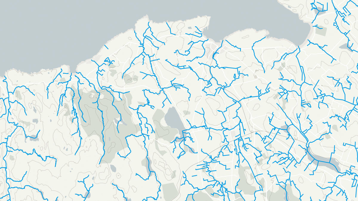
Working with Astun Technology and Ordnance Survey (OS), East Hampshire District Council are able to use planning tools driven by location data to identify local watercourses fast, speeding up the time it takes to respond to planning proposals. OS Open Rivers maps over 144,000km of watercourses by district – including freshwater rivers, canals and tidal estuaries.

Result

East Hampshire District Council can now quickly and easily assess the environmental risks of proposed developments, meaning they can respond to planning applications faster, and help protect both the general public and economy; the Solent; and its rich biodiversity – supporting the provision of homes for both Hampshire’s humans and wildlife.

"A clear overview is needed of the relationship between the waterways and the proposed areas of development."

East Hampshire District Council

Solutions for public sector organisations

Discover how your organisation can access world-leading location data and expertise

The Public Sector Geospatial Agreement (PSGA) supports the delivery of critical infrastructure and services, as well as working to help protect our environment.  

Learn more about the PSGA

Partners, products and solutions featured in this study

  • Astun Technology Ltd

    Astun Technology is the UK market leader for geospatial solutions with enterprise level support, built on Open Source foundations. Founded by Mike Saunt in 2005 Astun has developed an innovative suite of products and services which are now in use with over 60 organisations including Local Authorities, National Parks, Blue Light Services and Social Housing.

  • OS Open Rivers

    An open dataset of the high-level view of watercourses in Great Britain.