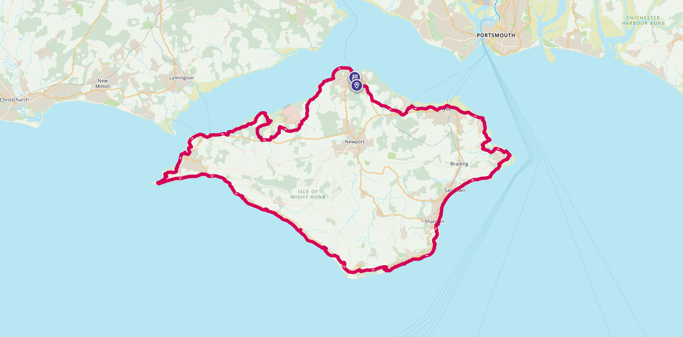
The Isle of Wight Coastal Path is a 70-mile waymarked walk which goes around the whole island. It hugs much of the coastline and can easily be split into shorter sections. Helen from the OS Team shares her experience of running the route in a day.
Whether you’re a seasoned hiker, an adventurous runner or just looking for a leisurely stroll, the Isle of Wight Coastal Path is a must-do route that showcases the natural beauty and rich heritage of this unique island. Along the way you’ll enjoy stunning views of the island’s dramatic cliffs, beaches and bays, as well as the Isle of Wight’s charming coastal villages and towns.
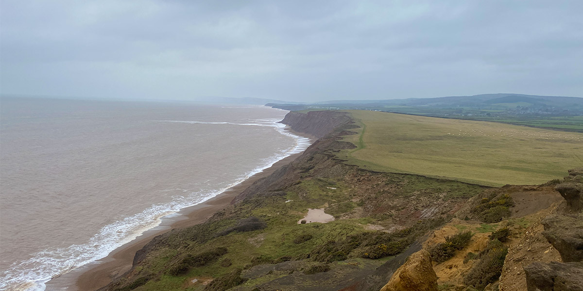
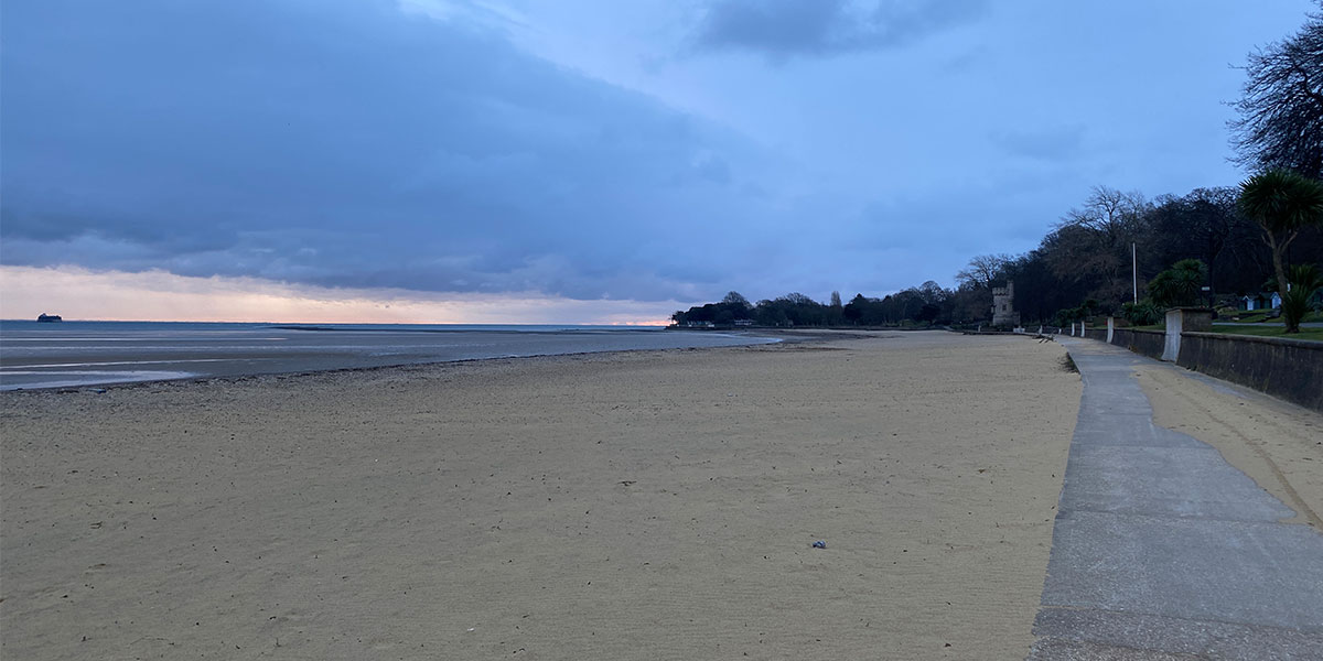
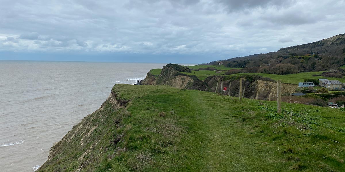
The south coast of the Isle of Wight on the Isle of Wight Coastal Path
The Isle of Wight can be reached by ferry from Southampton, Lymington and Portsmouth. We opted for the Wightlink FastCat from Portsmouth which took just 20 minutes to arrive in Ryde. You can start and finish the Coastal Path anywhere along the route but we were staying in a friend’s holiday home in Cowes, so it made sense to start from there. The route can be walked in any direction but most runners choose anticlockwise which means you end with a nice easy paved section. Due to the bitter easterly wind, we chose to run this route clockwise which had its pitfalls, but it meant we avoided running into the wind along the exposed south coast.
Looking for a challenge, we wanted to set the Fastest Known Time (FKT) for women to run self-supported around the Isle of Wight following the Coastal Path. Myself and Alicia Munro would be the first (women) to log it on the official FKT website and the only people to (officially) run this route in winter, self supported.
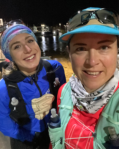
Catching the Cowes chain ferry at 5am
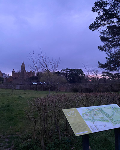
Quarr Abbey at sunrise
SZ 50125 95551
We caught the first chain ferry from Cowes to East Cowes which left at 5am. The chain ferry can be notoriously unreliable but we had no trouble at all. Check the service status before planning your journey. The first eight miles or so to Ryde was mostly on well-lit pavement following the main road which made it easy to navigate. Just before Ryde the route followed some small country lanes with no verges, which were thankfully very quiet at that time in the morning. The only sounds were the birds waking up and starting their day. I enjoyed the tranquillity of running past Quarr Abbey whilst the sun rose overhead.
SZ 59850 92769
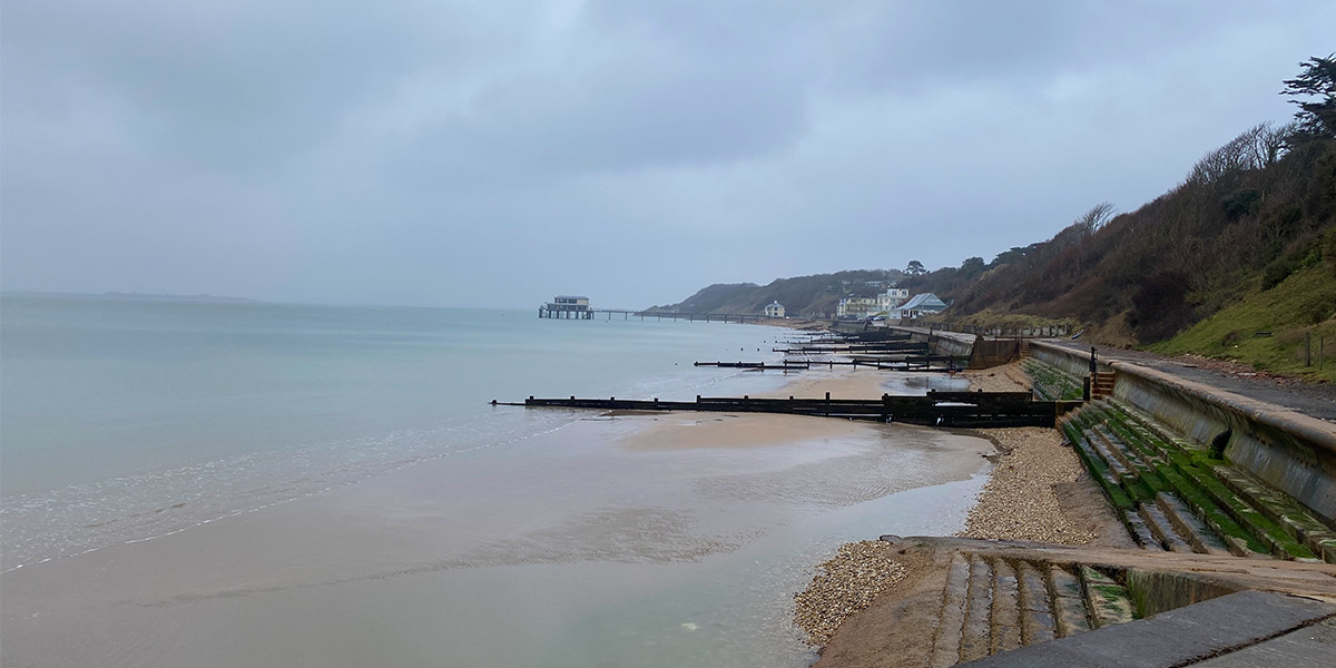
Ryde is one of the biggest towns in the Isle of Wight and there is a good selection of bars and eateries to enjoy right by the pier. We didn’t stop in Ryde because it was still early in the morning and Bembridge, the next main town, was only a few miles away. After Ryde, the route hugged the coast with views out to Portsmouth and beyond. It was still paved underfoot and easy to navigate, keeping the sea on our left.
The coastal path alongside Ryde beach
SZ 65602 88098
Passing the impressive Bembridge Lifeboat Station and weaving our way through residential streets, we somehow managed to completely pass Bembridge without seeing any shops. These are situated a few streets inland and not on the Coastal Path, so we had to carry on to Sandown. Pavement turned to trail and it was rather muddy underfoot as it had been raining on and off all morning. It was here we encountered our first proper hill, Culver Down, in which the 1849 Earl of Yarborough Monument sits on top. It was a fantastic run on soft grass across to Bembridge Down and into Sandown with expansive views across the south east coast of the island.
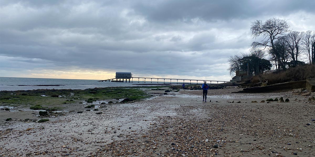
Lifeboat station at Bembridgex
SZ 60098 84298
Sandown had a real holiday feel to it, although there were very few people out and about due to the time of year and the poor weather. We picked up some much-needed food and drink in Sainsbury’s Local and walked along the promenade whilst eating our morning pastries. The promenade went all the way to Shanklin, another traditional seaside town with lots of summer attractions like mini golf, playgrounds and Shanklin Chine.
There had recently been a landslide around a charming wooded area very aptly named The Landslip on an OS Explorer map. Here we had to divert quite a bit inland which was incredibly hard to navigate but thanks to some local dog walkers, we didn’t lose too much time. It was a lovely undulating trail from there until Ventnor where we re-joined the seaside promenade.
Alicia on Culver Down
SZ 57550 77770
Ventnor would be the last town along the Coastal Path until we hit Yarmouth so we needed to stock up on food and drink. There looked like there may be a couple of shops in between, such as one at the Isle of Pearl but I was unsure if anything would be open at this time of year. Not wanting to take chances, we diverted off the trail and up/down a huge hill to Ventnor’s main high street. We filled our bags with water, snacks and a sandwich, really feeling the extra weight.
Ventnor
The hill around St Lawrence and The Undercliff seemed to go on forever so it was no surprise to learn that this is the highest point on the entire route. The trail was pleasant but it was very muddy in places and our shoes were made heavy by the sticky clay underfoot. This would be completely different in summer and a real delight to walk/run on. There were a couple of small diversions which put us back on a road but these were few and far between. It’s incredible to see how much the coast of the Isle of Wight is changing due to erosion.
St Lawrence and The Undercliff
SZ 48371 76769
I remember going to Blackgang Chine as a child and this time it was significantly quieter as preparations were being made to reopen in the spring. This part of the Coastal Path runs along a slightly undulating clifftop with great views all the way along the coast to The Needles. You could see exactly where you had to go and this beautiful vast coastline certainly kept us smiling, since our legs were heavy by this stage.
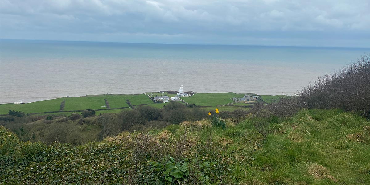
St Catherine’s Point lighthouse
Always on the lookout for an adventure, I was particularly pleased to see that we had our first obstacle to overcome near Brook Bay. We had to climb down a soggy clay slope, hop over a small river and climb up the other side. Although we were still following the route, I expect there was a diversion sign that we must had missed, since we were both running on autopilot.
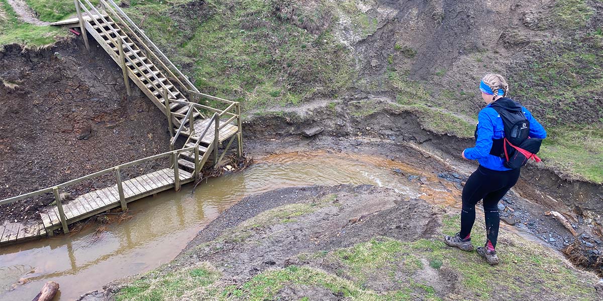
Alicia starting her crawl down the clay slope!
SZ 34691 85701
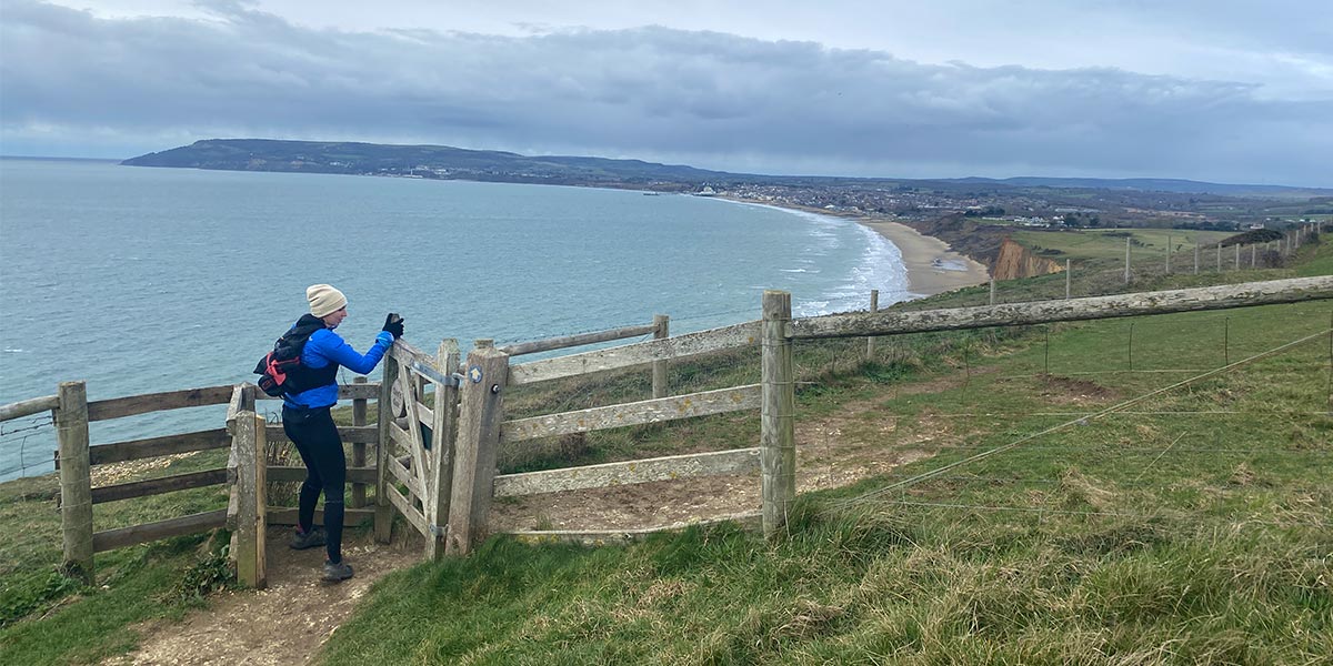
Freshwater Bay is a charming seaside town with a beautiful sandy beach. The town is slightly inland so we didn’t see much life but I can imagine it comes alive when the sun is shining. It was raining now but I was thankful we had the wind behind us as we power walked up the second major hill towards The Needles. Back up on the cliff, the Coastal Path cut through the large grass fields of Tennyson Down, passing the monument there. It then joined the Tennyson Trail, a 14-mile walk from Newport to Alum Bay.
SZ 30062 84812
By this point we were cold, wet and tired and visibility was poor so The Needles, one of the Isle of Wight’s top tourist attractions, would have to wait until our next visit. We continued down to the coastal promenade of Totland which was a welcomed stretch of asphalt with the most tranquil waters I’ve ever seen, thanks to the easterly wind. It was a haven for fishermen.
Tranquil Totland
SZ 35357 89633
It was dark by the time we reached Yarmouth and we took shelter in the only convenience store and stocked up on crisps and cake. Only 16 miles to go, we thought, which considering how far we had already run, was not much. Just outside of Yarmouth along Bouldnor Cliff and until the quaint village of Shalfleet, we experienced plenty of slouchy bog and ankle-deep puddles. It was slow going and would have been a completely different story should we have followed this route in better weather. A week prior to our trip, the whole of the UK experienced heavy rain and cold winds which is why the path was so muddy. Come spring or summer, this part of the route would have been one of my favourites. It didn’t help that it was dark and raining and we really did feel like we were out in the sticks. It was certainly type 2 fun and one we will never forget.

Alicia on Yarmouth bridge
SZ 47833 95854
Reaching Gurnard felt like we had won the lottery. We had now been running for 17 hours, much of it in the cold and rain, and Gurnard was a lovely looking town. We passed some beautiful houses and blossom trees coming into bloom. The route merged back on the promenade all the way to Cowes where we ran past fishermen making the most of the calm waters.
SZ 49617 96138
Cowes (west) is my favourite town along the route and we were lucky enough to be staying there. It was bustling with people enjoying their Saturday night as we hobbled around 11pm. To close the loop and officially complete the Isle of Wight Coast Path we had to run past our accommodation and down to the chain ferry but the satisfaction of knowing we had run around the entire Isle of Wight in one day more than made up for it.
Always something new to see on the Isle of Wight!
110km SZ 50013 95611
110 km / 68 miles
The Isle of Wight Coastal Path is a well-signposted trail of moderate difficulty. For a more leisurely experience than ours, I would recommend splitting the trail into manageable day walks and stay in towns along the route. It’s a great walk to do in the summer months where there will be no shortage of cafes, ice cream stands and restaurants to keep you fuelled. However, there is little in the way of shade, so do keep safe in the sun. There are many diversions along the official path and the route shown in this article was the one we took in March 2023. You can check the current footpath closures on the Isle of Wight here.
If you’re looking for a challenge and would like to run around it in winter, like Alicia and I, I would recommend doing a little research beforehand and adding key waymarks to the route in OS Maps so you know where and when you can get food and water. If you’re short on time, stick to the south coast between Ventnor and The Needles, it’s by far the most impressive with an abundance of wildlife and beautiful sea views.