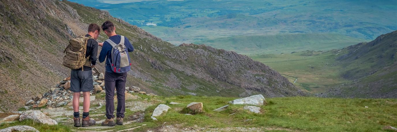
Outstanding circular walks from the OS Pathfinder Guides
Discover Britain’s 10 best circular walks from the OS Pathfinder Guides. Each walk provides key information like where to park and what to see on route.
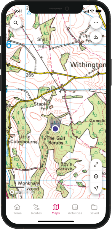
The popular OS Pathfinder Guides include a variety of fantastic walks, including the first in the series of accessible walks for all. With up to 28 walks per book, you can enjoy challenging longer routes up to 12 miles or shorter, easier routes between 3 and 9 miles long. They’re packed full of useful information like the terrain, the areas’ history and natural landscape. They also include OS Explorer map extracts for each walk and turn-by-turn instructions. Here our 10 of our favourite OS Pathfinder walks from all four corners of Britain.
OS Pathfinder Guides
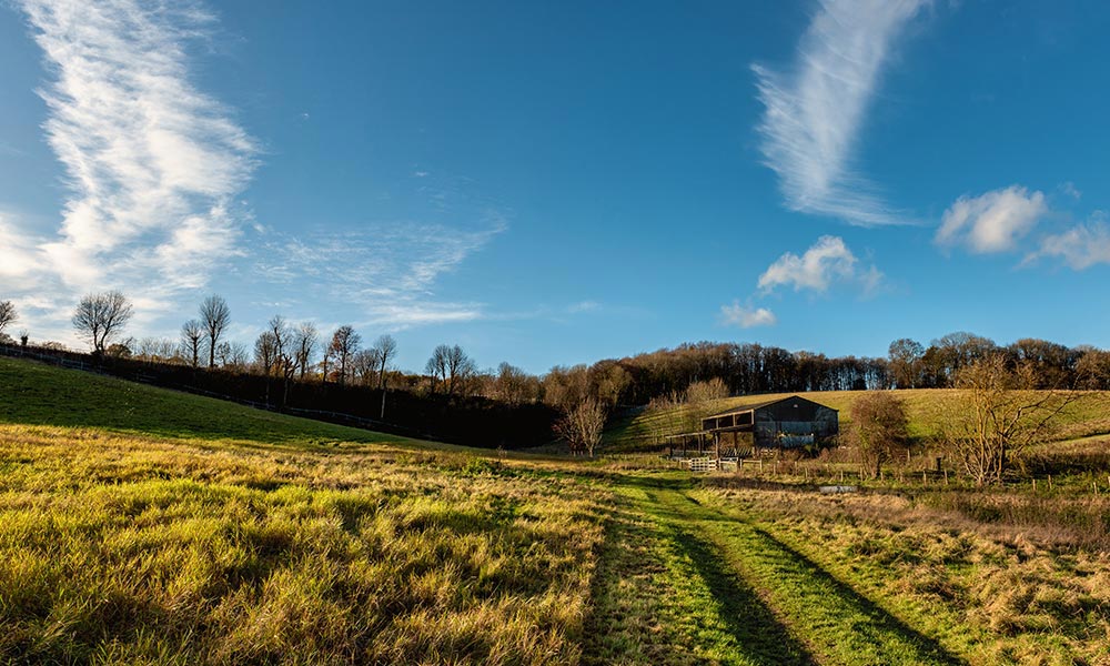
Talkin Tarn
Lake District & Cumbria Accessible Walks – OS Pathfinder Guide
• Distance: 1½ miles (2.25km)
• Start / Finish: Talkin Tarn Country Park
• Parking: Talking Tarn main car park (pay and display).
• Terrain: Hard-surfaced and relatively level route all the way round.
From the Lake District & Cumbria Accessible Walks – OS Pathfinder Guide
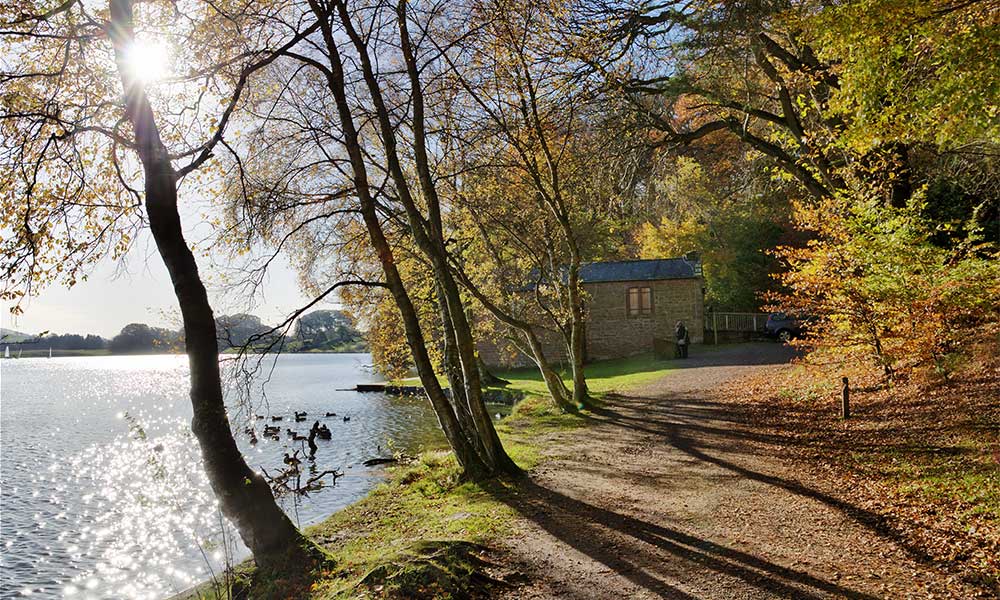
Talkin Tarn Country Park
This route is from the accessible OS Pathfinder range where every walk has been carefully created to be fully accessible by a wheelchair, pram or buggy.
Stunning Pennine views from this circuit of Talkin Tarn set within 120 acres (49 hectares) of woodland and meadows. Talkin Tarn is a 65-acre glacial lake formed around 10,000 years ago and fed by underground springs. It is surrounded by 120 acres of mature woodland and rolling meadows, and together they form Talkin Tarn Country Park. There is a well-maintained accessible path around the park with stunning views of the nearby Pennine Hills. The name Talkin comes from ‘Talcan’, the Celtic name for the brow of a hill, and Tarn is from the Viking term ‘Tiorn’ meaning a small lake. The existing buildings around the tarn were mainly built in Victorian times. Rowing has taken place here since 1850 and there is still an annual regatta with competitors from across the north of England.
Queen Elizabeth Country Park
New Forest, Hampshire & South Downs – OS Pathfinder Guide
• Distance: Woodland loop: 3 miles (5km) / Butser Hill loop: 21⁄2 miles (4km)
• Start / Finish: Queen Elizabeth Country Park visitor centre, off the A3 south of Petersfield
• Parking: Pay and Display car park at the start
• Terrain: Broad woodland track (woodland route) and grassy download on Butser Hill
From the New Forest, Hampshire & South Downs – OS Pathfinder Guide.
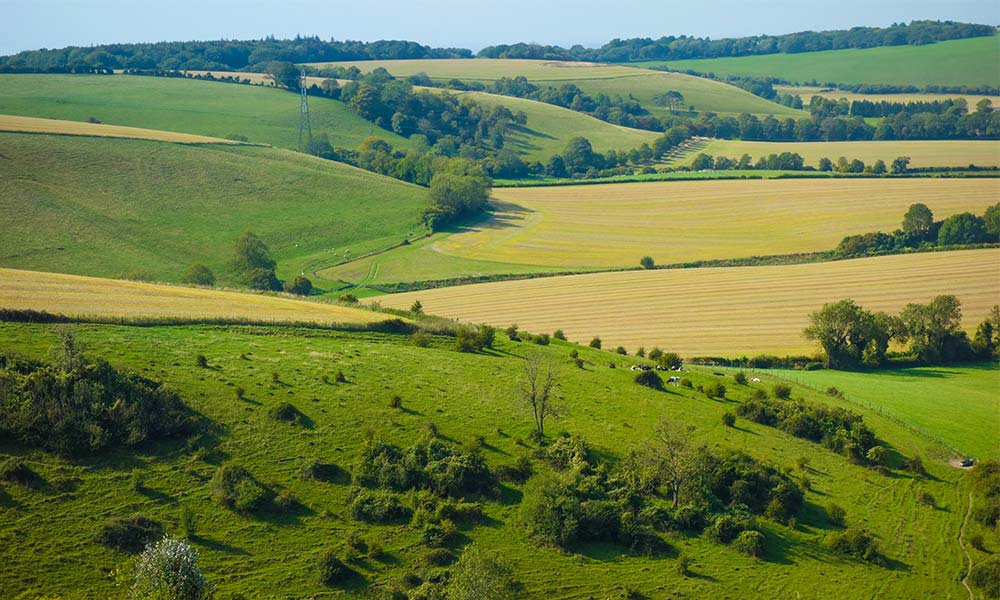
Views from Butser Hill
Queen Elizabeth Country Park straddles the A3 south of Petersfield, and this walk makes the most of its two very different faces. To the east, the gentler woodland loop follows well-made tracks through the native beech and conifer plantations of Queen Elizabeth Forest. West of the road, a stiff climb up the grassy slopes of Butser Hill is rewarded by a stunning 360-degree panorama from the highest point on the South Downs. You are advised not to attempt this section in poor visibility.
Lews Castle
Outer Hebrides – OS Pathfinder Guide
• Distance: 3½ miles (5.6km)
• Start / Finish: Stornoway / Steornabhagh
• Parking: Roadside parking bays on A857, Bayhead
• Terrain: Surfaced trails
From the Outer Hebrides – OS Pathfinder Guide.
Lews Castle
Lews Castle overlooks Stornoway, a Victorian castle built between 1844 and 1851 for Sir James Matheson, who had acquired the entire island of Lewis some years earlier. The grounds are extensive and offer hours of rambling opportunity including a link, not covered in this walk, to the promontory at Arnish Point lighthouse. During World War II, Lews Castle was used as a
hospital, and then a school and college. Today, after a chequered history, the castle is now used both as a visitor attraction and luxury self-catering apartments.
Kimmeridge Bay
Dorset – OS Pathfinder Guide
- Distance: 8¾ miles (14.1km)
- Start / Finish: Harting Downs, off the B2141
- Parking: Kimmeridge car park, ¼ mile (400m) north east of village
- Terrain: Coastal down and clifftop path
From the Dorset – OS Pathfinder Guide.
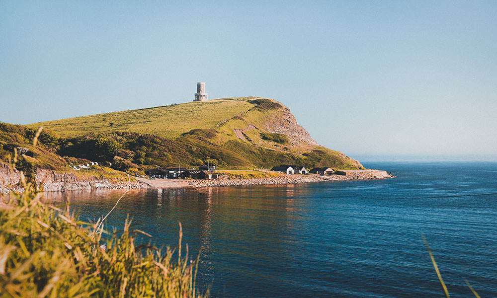
Kimmeridge Bay
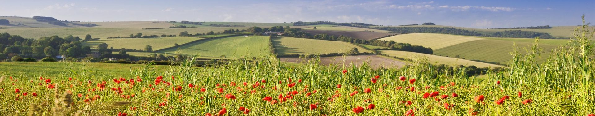
After a short walk across fields from Kimmeridge to the coast, there follows a lovely cliff-top trek above Kimmeridge Ledges, a remarkable stretch of wave-cut platform and part of the Jurassic Coast World Heritage Site. After a short but stiff pull on to Houns-tout Cliff, the route turns inland to Kingston and climbs steadily on to the superb viewpoint of Swyre Head. A glorious gentle descent along the down to Smedmore Hill provides a fitting conclusion to this grand ramble.
Bredon Hill
The Cotswolds – OS Pathfinder Guide
- Distance: 9¼ miles (14.7km)
- Start / Finish: Overbury
- Elevation: 1,340 feet (410m)
- Parking: By the church at Overbury
From The Cotswolds – OS Pathfinder Guide.
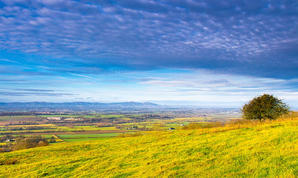
Bredon Hill
‘In summertime on Bredon
The bells they sound so clear;
Round both the shires they ring them
In steeples far and near,
A happy noise to hear.’
So wrote A.E. Housman, and certainly there can be few more pleasant places to be on a fine summer day than the summit of Bredon Hill. The bells that ‘sound so clear’ must refer to those in the churches in the many attractive villages that encircle the base of the hill, two of which are featured in the walk. This is the north-west frontier of the Cotswolds – Bredon’s familiar outline is detached from the main range by the Vale of Evesham and overlooks the low-lying country watered by Shakespeare’s Avon. The route falls naturally into two parts: the climb over the hill itself – lengthy but gradual and moderate – and a walk across the fields at its foot.
Binham Priory
Norfolk – OS Pathfinder Guide
• Distance: 4¼ miles (6.9km)
• Start / Finish: Binham
• Parking: Car park at Binham Priory
• Terrain: Field paths, tracks and quiet lanes
From the Norfolk – OS Pathfinder Guide
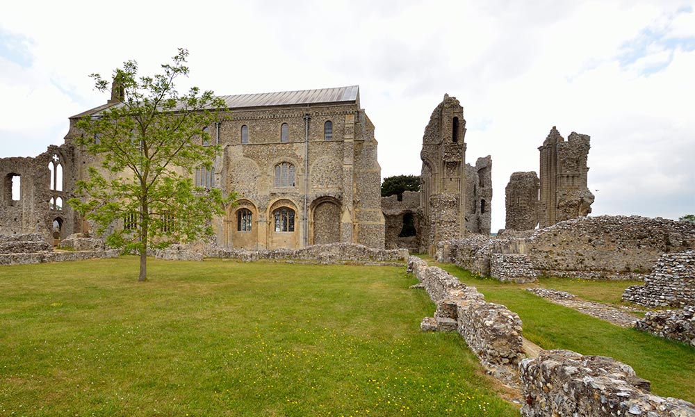
Binham Priory
An easy walk that is ideal for an afternoon stroll, the route following field tracks and secluded lanes around the small village of Binham. This attractive settlement is the site of a medieval Benedictine priory, whose impressive remains which include the parish church, can be freely visited.
Llyn y Fan Fach
Brecon Beacons – OS Pathfinder Guide
• Distance: 6 miles (9.7km)
• Start / Finish: Near Llanddeusant
• Parking: Parking off a track leading on from dead-end lane east from Llandeusant
• Terrain: A mixture of faint and clear paths over high mountains. Some steep going. Easy return along a broad track
From the Brecon Beacons – OS Pathfinder Guide.
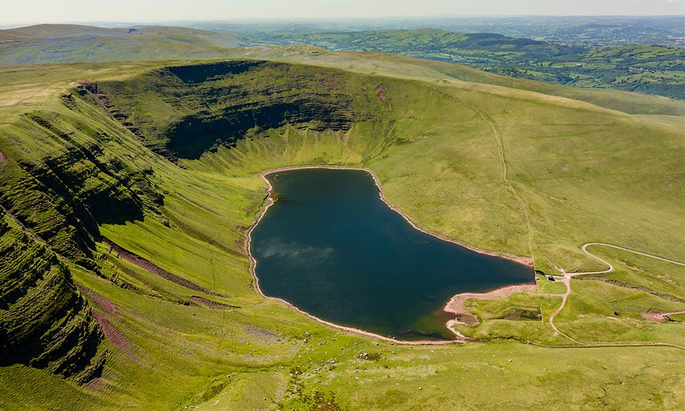
Llyn y Fan Fach
The Black Mountain (singular) is the western-most massif of the Brecon Beacons National Park and is often described as its last surviving wilderness, with sweeping, craggy escarpments that tower commandingly above glistening lakes, and a peaty upland plateau that bears few paths. This walk links a good waterworks track with a spectacular ridge-top path to create a short but extremely rewarding tour of the high escarpments at the western edge of the range, called Bannau Sir Gaer.
For more information about Llyn y Fan Fach and its array of fantastic circular walking routes, read our route guide.
The Cheesewring and Kilmar Tor
Cornwall – OS Pathfinder Guide
• Distance: 6 miles (9.4km)
• Start / Finish: Minions, Bodmin Moor
• Parking: Parking area by Minions Heritage Centre, 5 miles (8km) north of Liskeard
• Terrain: Grassy tracks, pathless moorland, rough underfoot; parts boggy after wet weather
From the Cornwall OS Pathfinder Guide.
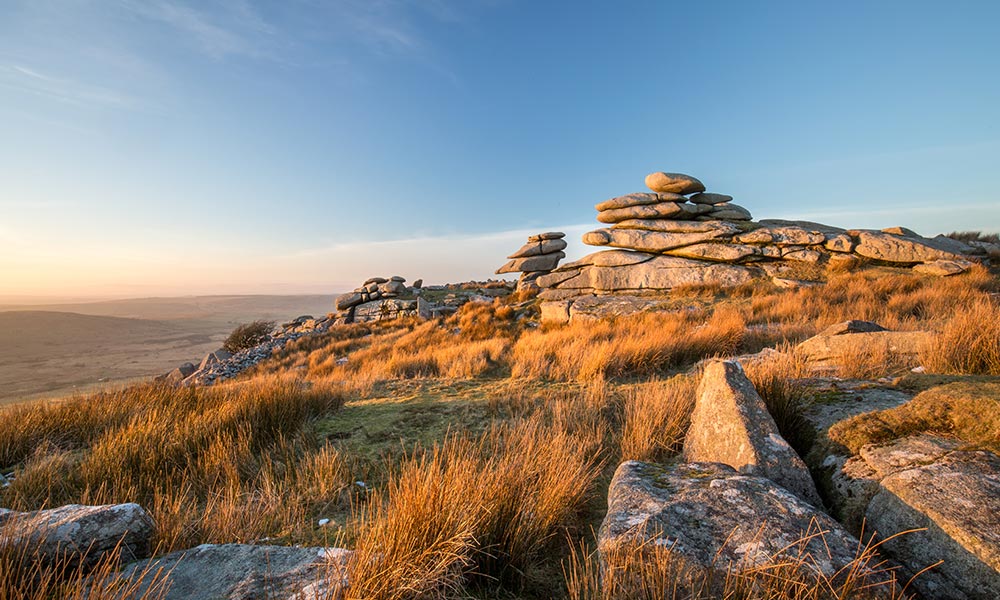
The Cheesewring and Kilmar Tor
A rough moorland walk with far-reaching views and a remote feel – and which needs good weather! The route visits the Cheesewring, one of Bodmin Moor’s iconic features, and crosses pathless moorland thick with remnants of the moor’s prehistoric and industrial past: tin has been mined here since Roman times, reaching its height in the 18th century. Minions, the highest village in Cornwall, dates from the 1840s when copper was discovered on Caradon Hill. Please note: Do not attempt this walk in poor visibility unless competent with map and compass.
Chess Valley
Thames Valley and Chilterns – OS Pathfinder Guide
• Distance: 9½ miles (15.2km)
• Start: Stony Lane parking area, north-east of Little Chalfont
• Parking: Stony Lane is just east of the outskirts of Little Chalfont, north off the A404 and the parking area is about ¼ mile (400m) up the lane from the main road towards Latimer
• Terrain: Frequent ascents/descents, lanes, tracks and field paths
From the Thames Valley and Chilterns – OS Pathfinder Guide.
Chess Valley
The Chess is one of a number of small rivers that rise in the Chilterns and flow south-eastwards into the Thames Basin. This walk explores a particularly attractive part of the Chess valley, linking a series of villages – Latimer, Flaunden and Sarratt – lying to the north of the river, and one, Chenies, to the south. It is a varied route with some outstandingly beautiful woodland – especially along the southern edge of Chipperfield Common – grand views and pleasant, if sometimes muddy, walking across riverside meadows. It is also quite a hilly and energetic walk, though none of the climbs are particularly steep.
Loch Coruisk
Isle of Skye – OS Pathfinder Guide
• Distance: 4½ miles (7km)
• Start / Finish: Loch na Cuilce jetty, by boat from Elgol
• Parking: Several parking areas at Elgol
• Terrain: Rough, rocky slopes and boggy terrain throughout; river crossings at start and mid-way (which may be impassable after rain)
From the Isle of Skye – OS Pathfinder Guide
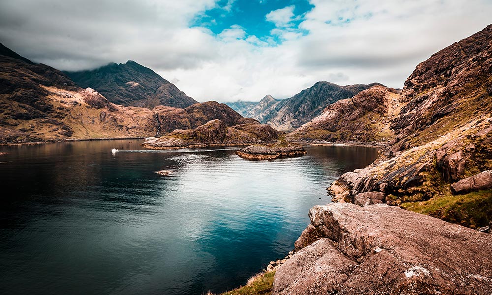
Loch Coruisk
Located at the very heart of the Cuillin, Loch Coruisk (pronounced Corr-oosh-k) is arguably the most splendid of Scottish freshwater lochs. The terrain is such that you will almost certainly get wet feet, but that’s a valid price to pay for the matchless mountain scenery that surrounds you. The loch can be accessed via a long walk-in from Sligachan or from Kilmarie via Camasunary and the notorious ‘Bad Step’, which is not for the feint hearted. If the water level prevents the complete circuit, then the south side of the loch is still worth exploring, bogs and all.
Important info: The start for this walk is Loch na Cuilce jetty, reached by boat from Elgol. Book return ferry tickets in advance through Misty Isle Boat Trips, 01471 866288, www.mistyisleboattrips.co.uk or Bella Jane, 01471 866244, www.bellajane.co.uk. Check the times of the return ferry and during the walk, be sure to keep an eye on the clock. Allow 3 to 4 hours for the walk, excluding picnic stops.
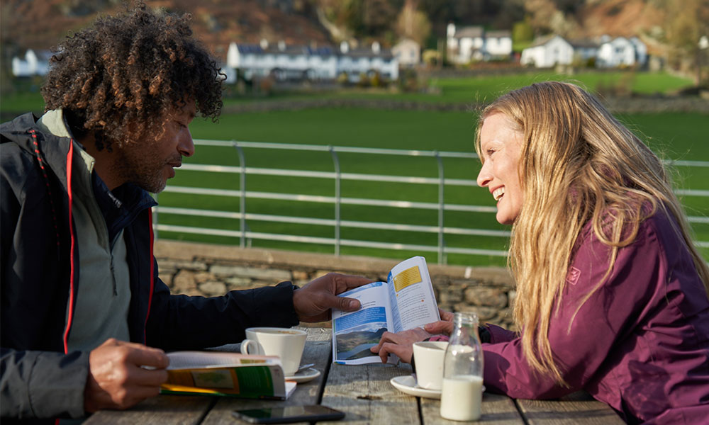
These may be our favourite circular walks in Britain but there are plenty more to explore! Our growing collection of OS Pathfinder Guides help you plan your next adventure at home and follow the routes when you’re out. Want to find out more? Check out our guide to OS walking books so you can choose the right guide for you.