5 popular premium products available for the public sector via the OS Data Hub
Through the Public Sector Geospatial Agreement (PSGA) and consequent creation of the OS Data Hub, we're delivering the next generation of location data and transforming the way people access, share and innovate with geospatial data.
Here, we've selected 5 popular premium data products now available for download for public sector PGSA members via the OS Data Hub. Read on to find out how you can bring your solutions to life with OS data and APIs…
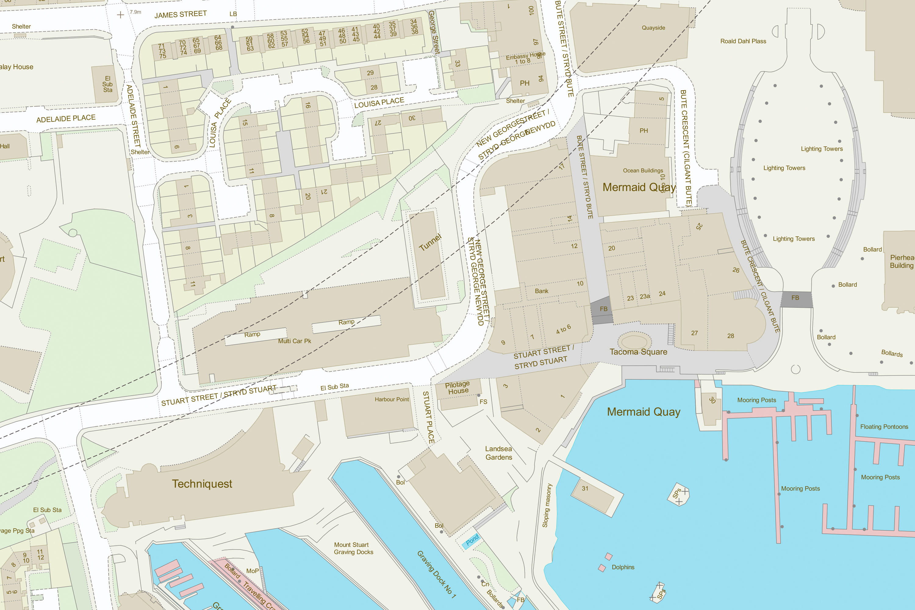
OS MasterMap Topography Layer
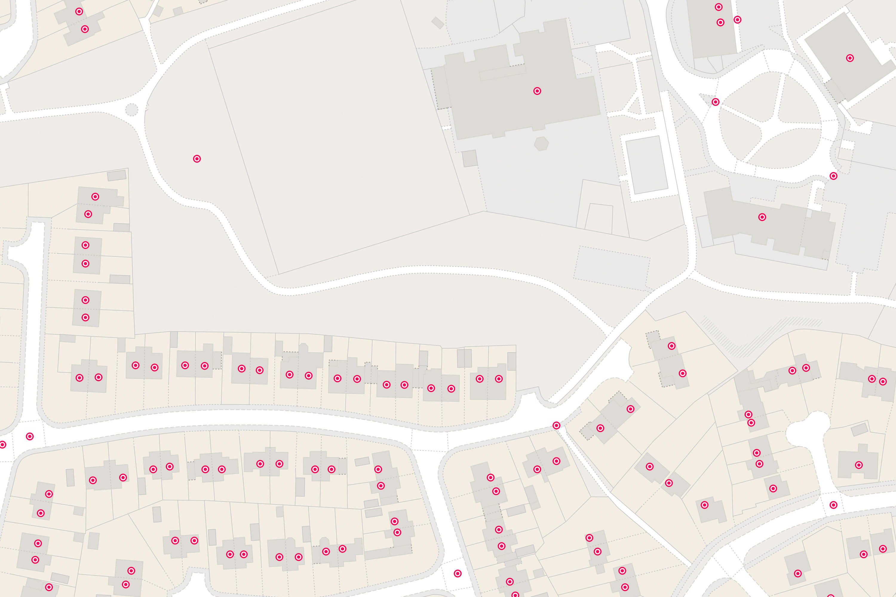
As the most detailed, current and comprehensive dataset of the physical environment of GB, the OS MasterMap Topography Layer has close to 500 million real-world objects including roads, buildings, parks and waterways. It offers an accurate visual context to help you interpret addresses, routes and imagery provided by other layers. With this data, you’ll make better-informed decisions about customers, operations, assets and environmental risks.
All the real-world objects are represented by a unique identifier allocated by OS known as a Topographic Identifier (TOID). This is specific to the particular feature throughout that its lifecycle, and this feature will be identified by that same TOID across all of the OSMM products.
Did you know… with 15.3%, Greater London holds the highest building area percentage in Great Britain?
Discover OS MasterMap Topography Layer.
Interested in TOIDs? Read more about OS identifiers.
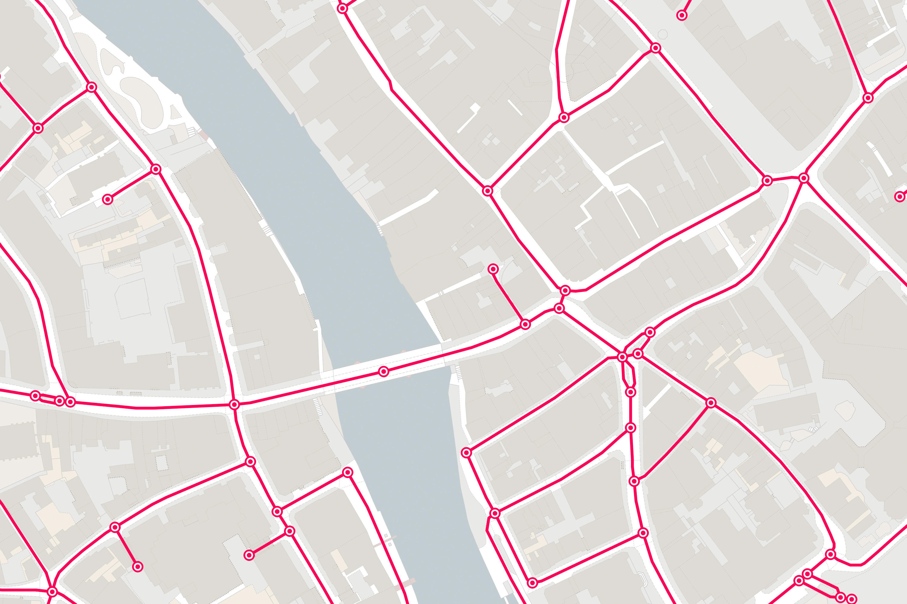
OS MasterMap Highways Network
OS MasterMap Highways Network is the most complete, detailed and accurate navigable road network dataset for Great Britain – it records the dimensions and accessibility of roads. From roads with routing and asset management to average speed and speed limits, the data in our OSMM Highways Network portfolio is available as 6 different datasets.
As the range of authoritative data sources are matched into one dataset, disparity between datasets is reduced and results in a single source of trusted, authoritative data across GB. The unique and consistent TOIDs and Unique Street Reference Number (USRNs) enables linking and sharing of data against key identifiers.
With OS's highly detailed accurate geometry of the road network, users can visualise complex road layouts and conduct detailed analysis and length calculations. The routing information allows consistent approach to routing across GB and enables detailed route planning even for vehicles of abnormal load or buses etc.
Did you know… at 18,755.90 km, the county of Devon has the largest total road length in Britain?
Discover how this data is supporting digital transport services.
Find out more about OS MasterMap Highways Network.
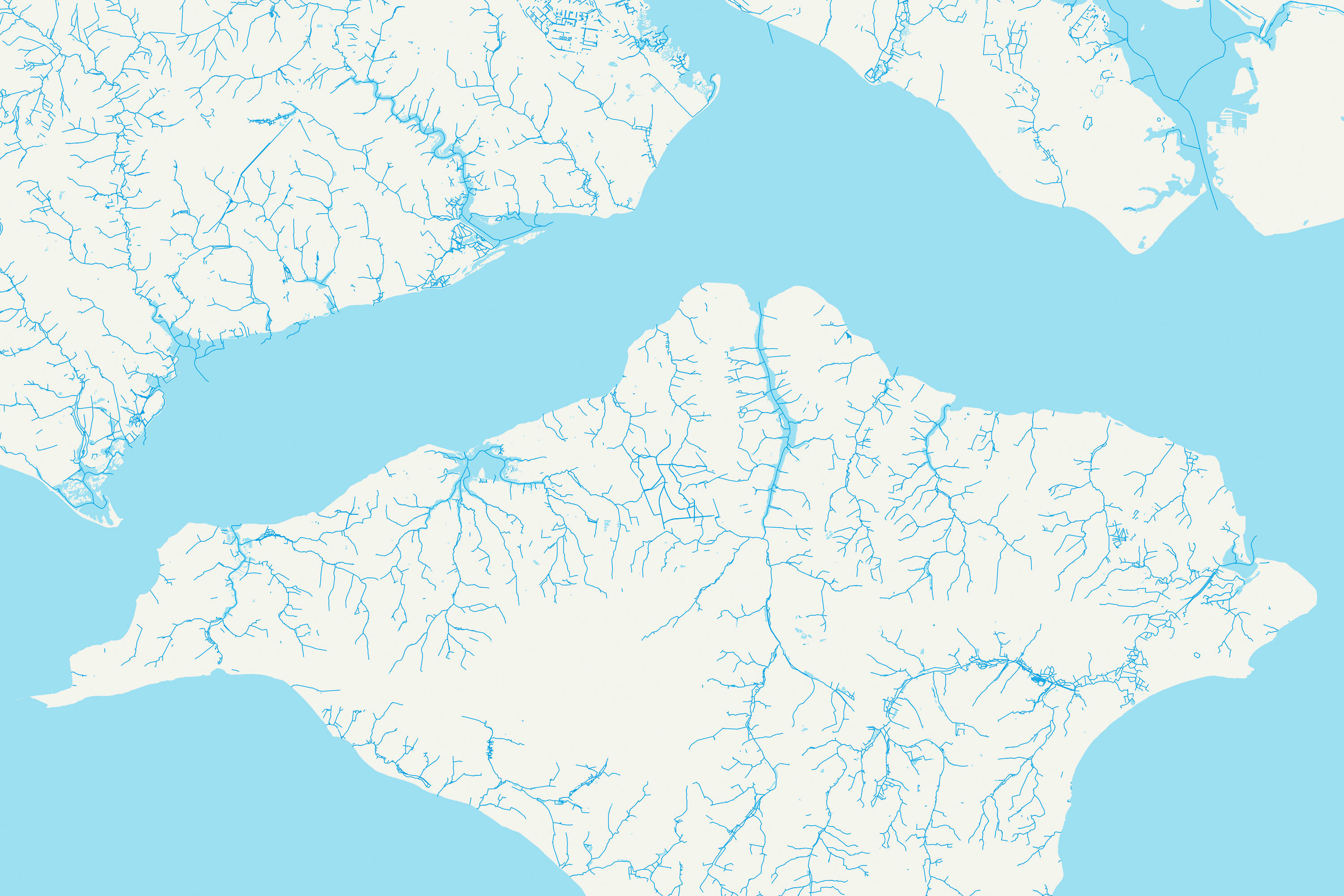
OS MasterMap Water Network Layer
The OS MasterMap Water Network Layer offers one of the world's most detailed, heighted water networks, showing the flow and precise course of every river, stream, lake and canal in Great Britain.
This dataset is a crucial element in understanding our natural environment. As one of the world's most detailed, heighted water network of Great, OS MasterMap Water Network is continually updated and improved, showing the flow and precise route of watercourses at a national and local level.
With this water network data, you can look up the height of any water course, along with its flow direction, gradient, length and width anywhere along its length.
For areas such as risk analysis, surveying and engineering, this Layer offers the potential to model in 2D and 3D like never before thanks to the clarity of river flow, gradient and river widths. Combined with the OS MasterMap Topography Layer, you can see watercourse data in context with 3D height data!
Did you know… Inverness has the largest total river length in GB at 6,922.97 km?
Learn how OS mapping improved Wiltshire's flood management.
Unearth the OS MasterMap Water Network Layer.
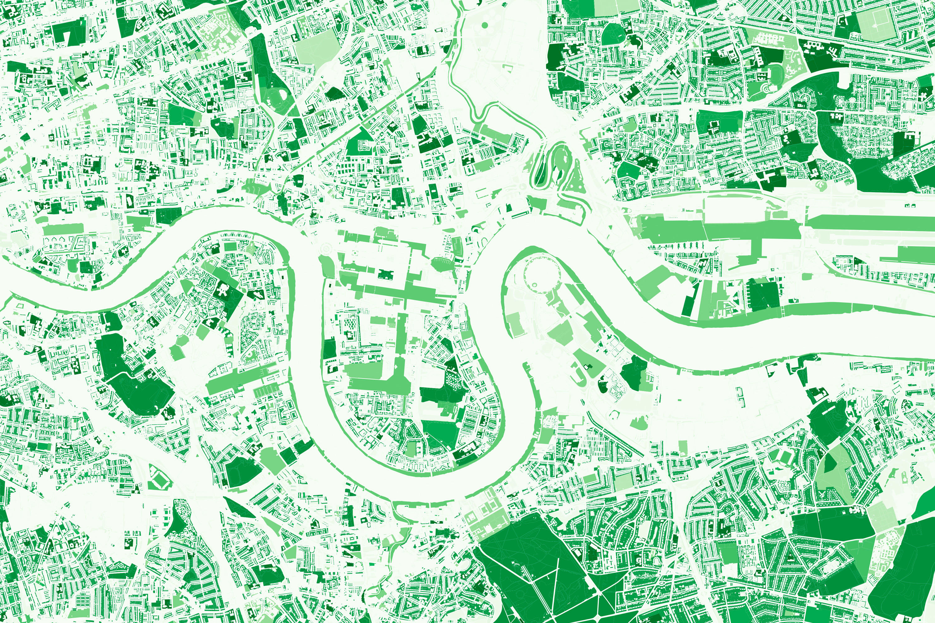
OS MasterMap Greenspace Layer
As Britain's most comprehensive dataset of urban greenspaces, the OS MasterMap Greenspace Layer provides accurate and up-to-date information to support a wider set of government initiatives around health and the environment.
From policymaking to managing air quality and availability, our greenspace data has been heavily used throughout the Covid-19 pandemic by organisations such as Office of National Statistics (ONS).
Did you know… Greater Manchester has 8.3% area of greenspace?
Read about the ONS work and learn more about the OS MasterMap Greenspace Layer.
AddressBase Premium
Our AddressBase Premium dataset gives the most up to date, accurate information about addresses, properties and land areas. As with many of our other products, this uses a consistent unique identifier to manage assets, namely Unique Property Reference Number (UPRN).
AddressBase Premium has all the information you'll need to conduct risk analysis at the level of individual addresses. The properly life cycle insight you'll gain from this dataset can give you all you need to shape the way you plan, operate and communicate with your audience.
Did you know… there are over 40 million addresses in Britain?
Find out how Ofcom used our property-level data to enable faster and better internet.
Avoid errors with AddressBase Premium.
What is the OS Data Hub?
The OS Data Hub is the new way to access our authoritative location data. Through the OS Data Hub, customers can access OS data through download or our new range of location APIs.
As of today (2 June 2021), the premium data products mentioned in this blog are available for download to public sector PGSA members via the OS Data Hub.
Statistics sourced from Open Data Insights.
Explore the OS Data Hub
With over 20,000 updates to our databases every day, you have access to a comprehensive and up-to-date set of authoritative data through the OS Data Hub

Our highly accurate geospatial data and printed maps help individuals, governments and companies to understand the world, both in Britain and overseas.