Data visualisations show Britain’s most trodden paths
Our Data Scientist Andrew Radburn set to work analysing the data before our Data Visualisation expert Charley Glynn set to work to showcase the results.
Analysing OS Maps route data
Andrew broke Great Britain down into kilometre squares (280,345 of them) to analyse all of the routes passing through each one. We discovered that:
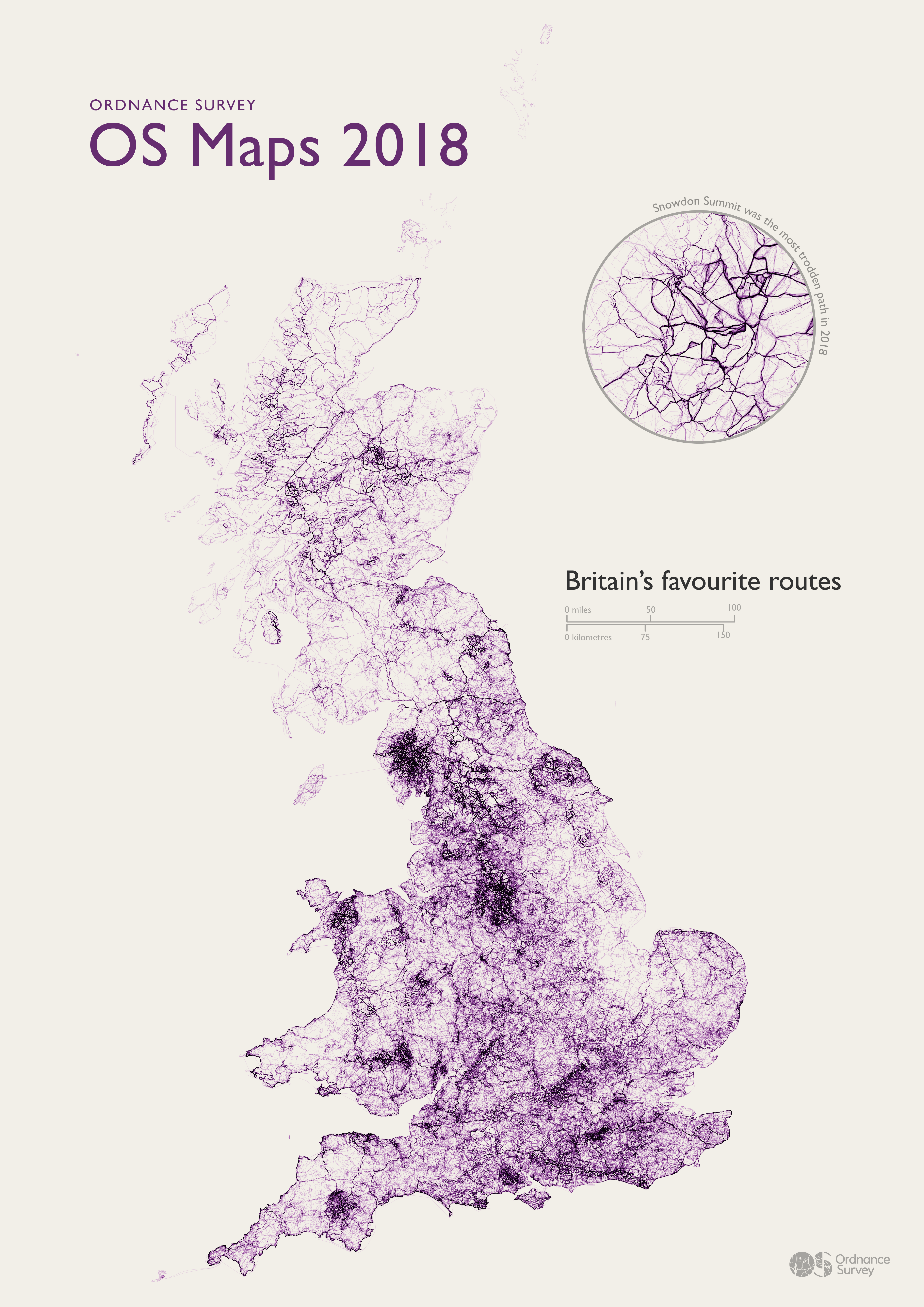
- Snowdon has the busiest 1km2 grid square in Britain with 2,370 routes at the summit (SH6054)
- The Peak District village of Edale (SK1285) has the grid square with the most starting points for routes.
- Grid square SK1789 featuring Fairholmes in the Peak District has the most end points for routes (is there a good pub we wondered?)
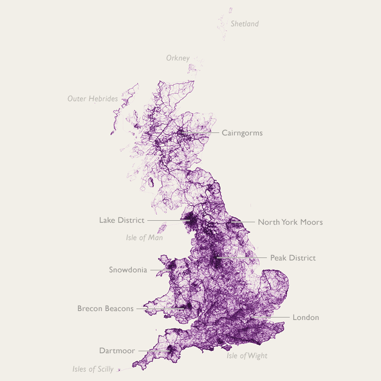
The National Parks, unsurprisingly, dominated the 20 busiest grid squares, with Snowdonia, the Lake District and the Peak District filling all of the spots. But we were pleased to see plenty of routes passing through our towns and cities, with Brighton, Manchester and Birmingham all featuring highly.
Visualising the OS Maps route data
Charley took Andy’s results and set about creating a series of data visualisations to showcase the results. The overview poster for 2018 is the third in the series, showing the geography of Great Britain solely through OS Maps routes. The darker areas demonstrate a higher concentration of OS Maps routes. You can compare it to 2017 and 2016 in our previous blogs.
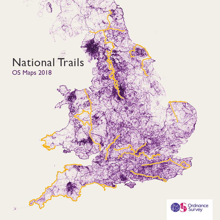
The heavy colouring around National Parks and National Trails around Great Britain speak for themselves, but Charley was also drawn to how clearly some coastal areas are defined through people’s routes. He picked some areas of interest to look into, including the South West of England, shown below.
His work also showcases the areas we don’t create as many routes, often in beautiful areas. It’s surprising that Carmarthenshire, west of the Brecon Beacons, is one of the areas of Great Britain with the fewest recorded routes.
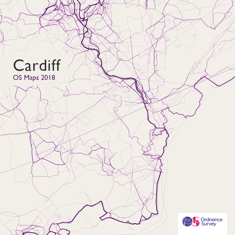
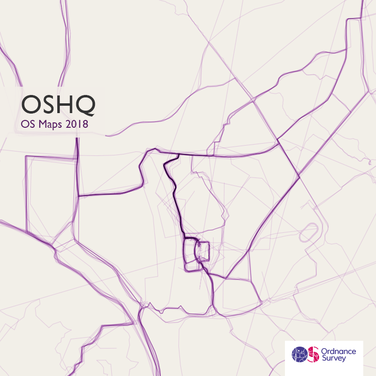
Ensuring that we live the GetOutside image that we promote at OS, we were also pleased to see our head office site in Southampton clearly outlined, from the number of team members who head out for walks, runs and cycle rides over the lunch period!
Both Andrew and Charley have enjoyed working on the third iteration of our OS Maps data. Since the service launched in 2015, users have added more than 2.3 million private and public walking, running and cycling routes. These routes can now be viewed on a map, or as 3D fly-throughs and even in real-life Augmented Reality using the Tabletop 3D feature. Find out more about OS Maps on our website.
Top 20 1km grid squares
| 1 | SH6054 Snowdon (Summit) |
| 2 | SK1285 Edale |
| 3 | NY2107 Scafell Pike |
| 4 | NY2308 Allen Crags |
| 5 | NY2208 Great End / Long Pike |
| 6 | NY3415 Helvellyn |
| 7 | SK1384 Edale (Hollins Cross) |
| 8 | SK1687 Hope Cross |
| 9 | SK1587 Crookstome Hill |
| 10 | SK1789 Fairholmes |
| 11 | NY2806 Dungeon Ghyll / Raven Crag |
| 12 | NY3704 Ambleside |
| 13 | NY2514 Longthwaite |
| 14 | SK1283 Edale (Mam Tor) |
| 15 | NY2906 Great Lngdale |
| 16 | SK0886 Edale Head / Jacob’s Ladder |
| 17 | SK0786 Edale Cross |
| 18 | NY3511 Fairfield |
| 19 | NY3414 Nethermost Pike |
| 20 | SH6455 Pen-y-Pass |
See all of Charley’s stunning data visualisations on our Flickr page: https://www.flickr.com/photos/ordnancesurvey
With thanks to Scottish Natural Heritage for the data on Scotland’s Great Trails.

Our highly accurate geospatial data and printed maps help individuals, governments and companies to understand the world, both in Britain and overseas.