OS data being used to predict coastal change in Scotland
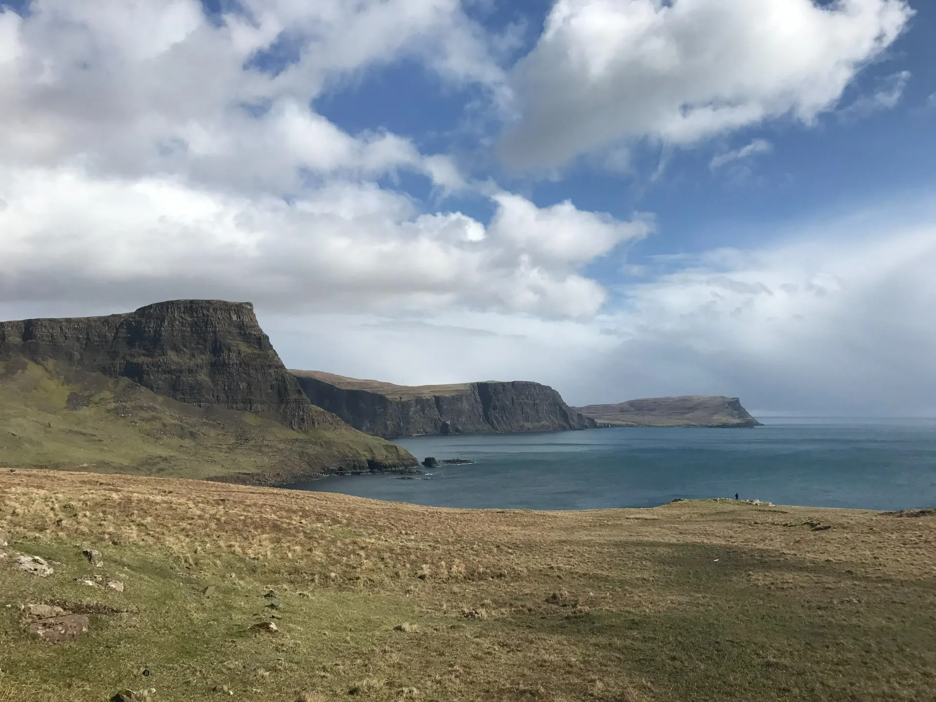
It’s safe to say that most Britons are fans of the coast and there’s a good chance that you’re aware of coastal change to some degree. Whether it’s investment in coastal defences, cliff falls or erosion impacting landowners, coastal change often hits the news.
Great Britain has tens of thousands of kilometres of coastline, which is a key resource and home to communities, businesses and infrastructure – as well as being a great place to holiday. Looking at Scotland, around 20% of the population live within 1km of the coast, that’s around 1 million people. Yet 19% of the coast is erodible or ‘soft’.
What does that mean for the coast? According to Dynamic Coast it means that thousands of assets are at risk. Within just 50m of the Scottish coast lie 34,000 buildings, of which 72% are residential properties. You also have 1,300km of roads, 100km of rail networks and 600 natural heritage sites.
Dynamic Coast is Scotland’s National Coastal Change Assessment
The UK’s Climate Change Risk Assessment anticipates increases in sea level, coastal erosion and coastal flooding to increasingly affect Scotland’s soft coastlines and the coastal assets. Dynamic Coast aims to create a shared evidence base to support more sustainable coastal and terrestrial planning decisions in the light of a changing climate.
In 2015 the CREW-funded research started and since then we have been working with partners, led by the Scottish Government and Scottish Natural Heritage. Roseanna Cunningham MSP, Cabinet Secretary for Environment, Climate Change and Land Reform, launched the Dynamic Coast in August 2017 and thanked OS for being a partner and updating our coastal data to meet the project requirements.
The researchers at the University of Glasgow needed to establish what is erodible and what had already eroded. They managed this through extracting 3,800 km of georectified coastline position from OS 2nd Edition Country Series maps (1892-1905) and to then compare it to both the 1970s and the current coastal position (updated by OS maps and LiDAR datasets where available) to estimate historical and recent erosion/accretion rates. Using the recent coastal change rates the coastline position has been projected into the future. Using the erosion rates combined with a number of socio-economic datasets, key assets at risk from future coastal erosion have been identified.
Dynamic Coast’s findings will inform existing strategic planning (Shoreline Management Plans, Flood Risk Management Planning, Strategic and Local Plans, National and Regional Marine Planning etc) and identify those areas which may remain susceptible in the coming decades and would benefit from mitigation and adaptation planning.
What did Dynamic Coast find out?
Since the 1970s, 77% of Scottish ‘soft’ coast could move – but it hasn’t. Meanwhile 11% of soft coast has advanced more than 10m seaward and 12% of soft coast has retreated more than 10m landward. That’s 423km of coastline advanced (accreted) and 442km retreated (eroded); the equivalent distance from Edinburgh to John O’Groats.
Looking at the map evidence across time, the team identified that more coast is experiencing erosion and that where it happens; it’s twice as fast as before. These assessments identify at least £340m of coastal assets are at risk by 2050 if recent erosion continues. However over £13bn of assets are protected by beaches and dunes, our ‘natural defences’. Contrasting this, £5bn of assets lie behind man-made defences.
As coastal flooding and erosion often operate together, they need to be treated together. Dynamic Coast can help the public sector, business and communities work together to make more sustainable planning decisions, increase resilience and help us cope better with climate change.
"Working closely with the OS, we have appreciated changes to Scotland’s coastline at a level never achieved before. Dynamic Coast informs the public sector, businesses and communities of the past changes and future implications of coastal erosion, as climate change continues to affect our coasts."
Where can I find out more about Dynamic Coast?
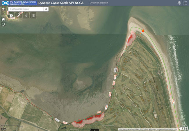
Head to www.dynamiccoast.com to read more about the work and see the interactive maps showing coastal change around Scotland. The strategic assessment tool uses OS data, including coastal topographic data and tide lines, to assess and predict rates of change and identify areas at risk.
The Public Sector Geospatial Agreement
Ordnance Survey and the Geospatial Commission
The Public Sector Geospatial Agreement (PSGA) is a contract between Ordnance Survey and the Geospatial Commission, on behalf of the public sector in England, Wales, and Scotland. It's the route for public sector member organisations to access, use and share our ever-evolving location data.

Our highly accurate geospatial data and printed maps help individuals, governments and companies to understand the world, both in Britain and overseas.