CASE STUDY

OS data helps keep hospital open in Somerset

Ordnance Survey data provided critical evidence leading to Somerset Clinical Commissioning Group keeping stroke services at two hospitals.

OS data provided critical evidence to keep stroke services at two hospitals.

In 2014, Somerset Clinical Commissioning Group (CCG) looked into how a proposed centralised stroke service, based at Taunton Hospital, would affect the population of Somerset as a whole.

Public Sector Mapping Agreement (PSMA) data from Ordnance Survey provided critical evidence leading to Somerset CCG keeping stroke services at both Yeovil and Taunton hospitals.

|2 MIN READ

  • Basemap Limited
  • 1:250 000 Scale Colour Raster
  • Boundary-Line
  • Code-Point with Polygons
  • Code-Point Open

Challenge

A major service review recommended that closing the stroke services at Yeovil Hospital would benefit patients clinically.

However, the review posed the following challenges:

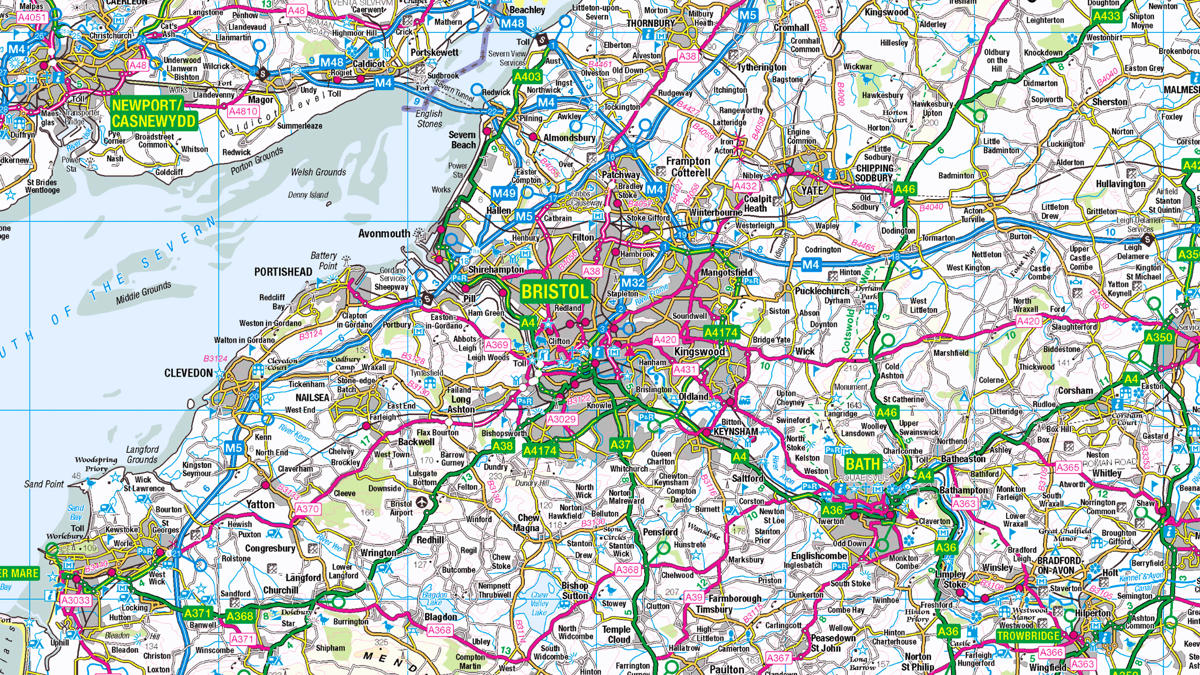
  • Research into how the proposed changes would impact such a large county, measuring 1,330 square miles and 70 miles across, was critical before any decision was implemented.
  • A sophisticated analytical tool was needed to confirm the review's findings.

Solution

The South West Commissioning Support (SWCS) Unit’s Geographical Information System (GIS) team used innovative analytical techniques with MapInfo Professional, RouteFinder and Basemap’s TRACC system – designed to quickly and accurately calculate various travel times.

Maps and reports were produced showing travel access times to the two current hospital sites at Taunton and Yeovil. These included blue light emergency transport times, private and public transport options, population numbers within travel times, and locations of stroke cases.

Result

  • Complex information on travel times and the potential implications on patients was presented in an easy to understand way. This evidence-based information resulted in accurate decision making
  • The GIS study confirmed that the clinical benefits of closing Yeovil Hospital would be less than anticipated. In fact, the increased travel times would have a critical impact on the speed of treatment for many stroke patients
  • The critical evidence informed the planning process and led to Somerset CCG deciding to retain both stroke services, substantially altering the direction of the review
  • The methodology and techniques used are easily replicable for other geographical areas.

"This is the biggest project we have been involved with in the last few years, in terms of impact and influence GIS has had on NHS decision making."

Trevor Foster, SWCS GIS Manager

Solutions for public sector organisations

Discover how your organisation can access world-leading location data and expertise

The Public Sector Geospatial Agreement (PSGA) supports the delivery of critical infrastructure and services, as well as working to help protect our environment.  

Learn more about the PSGA

Partners, products and solutions featured in this study

  • Basemap Limited

    Established in 2000, Basemap Limited is a specialist provider of digital mapping, travel time analysis and transport data solutions to both the private and public sector.

  • 1:250 000 Scale Colour Raster

    1:250 000 Scale Colour Raster is an open dataset of the regional view of towns and villages, roads and places of interest.

  • Boundary-Line

    Ordnance Survey's Boundary-Line™ is an open dataset of every administrative boundary in Great Britain.

  • Code-Point with Polygons

    Code-Point® with Polygons shows the notional shape of every postcode unit in Great Britain including buildings with multiple postcodes.

  • Code-Point Open

    Ordnance Survey's Code-Point® Open is an open dataset of all the current postcode units in Great Britain.