Challenge
Local authorities are under pressure to deliver greater operational efficiencies, as well as keeping thousands of kilometres of roads safe and maintained – especially in the winter months.
Optimising their gritters, gully-cleaners, road sweepers, refuse trucks and white van fleets is a huge operation, and there are big costs involved.
For example, a single precautionary gritting treatment costs on average £17,000 on roads.
Solution
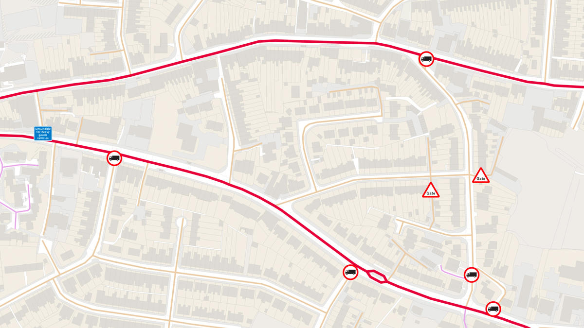
OS’s enhanced mapping contains current and future road developments (such as new roads planned for the coming year). Maps utilise key road section attributes such as ‘class of road’, ‘road width’ and ‘topography values’, enabling inclines and slopes to be determined and providing more accurate journey times.
Result
Customers can:
- Enjoy full control of their route network management via an online portal with a user-friendly interface.
- Customise routes and generate bespoke instructions for route navigation.
- Quickly and easily amend routes to react to changes in real time such as temperature changes, diversions, and road & weather conditions to save time, mileage and amount of salt deployed.
- Create and manage gritter automated spreading controls and add instructions to each route (including turn-by-turn guides for drivers).
- Manage multiple passes of travelled road sections for salting and free travel.
- Calculate accurate route timings and distance statistics based on configurable driving speeds for both spreading and free travel sections.
- Get the latest updates on road infrastructure to amend routes accordingly and ensure maximum vehicle efficiency.
- Save significant costs by only gritting the treatment sections along the route in cold weather.
"All the Ordnance Survey maps are now hosted in the Cloud in partnership with Astun Data Services, served and rendered using the latest open source technologies, which deliver terrific performance and a further saving on software licence fees. Provision of the maps comes courtesy of the Public Sector Mapping Agreement (PSMA), together with recently-released OS OpenData which provides our local authority customers with the precision of OS MasterMap and beautiful screen-based maps at every level of zoom. From an operational viewpoint, the new system will enable huge savings in fuel, salt and vehicle wear and tear by creating more efficient routes."