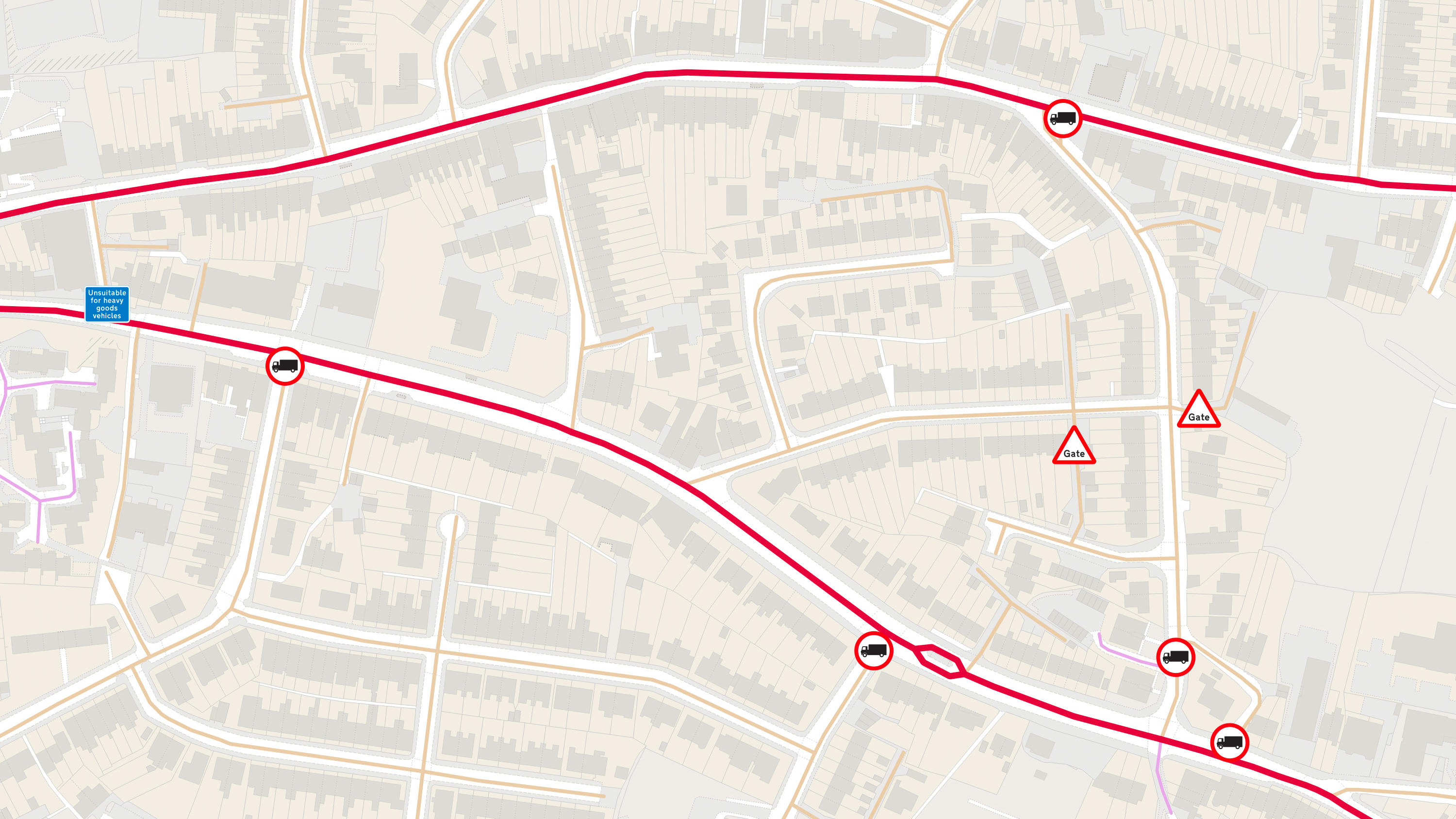
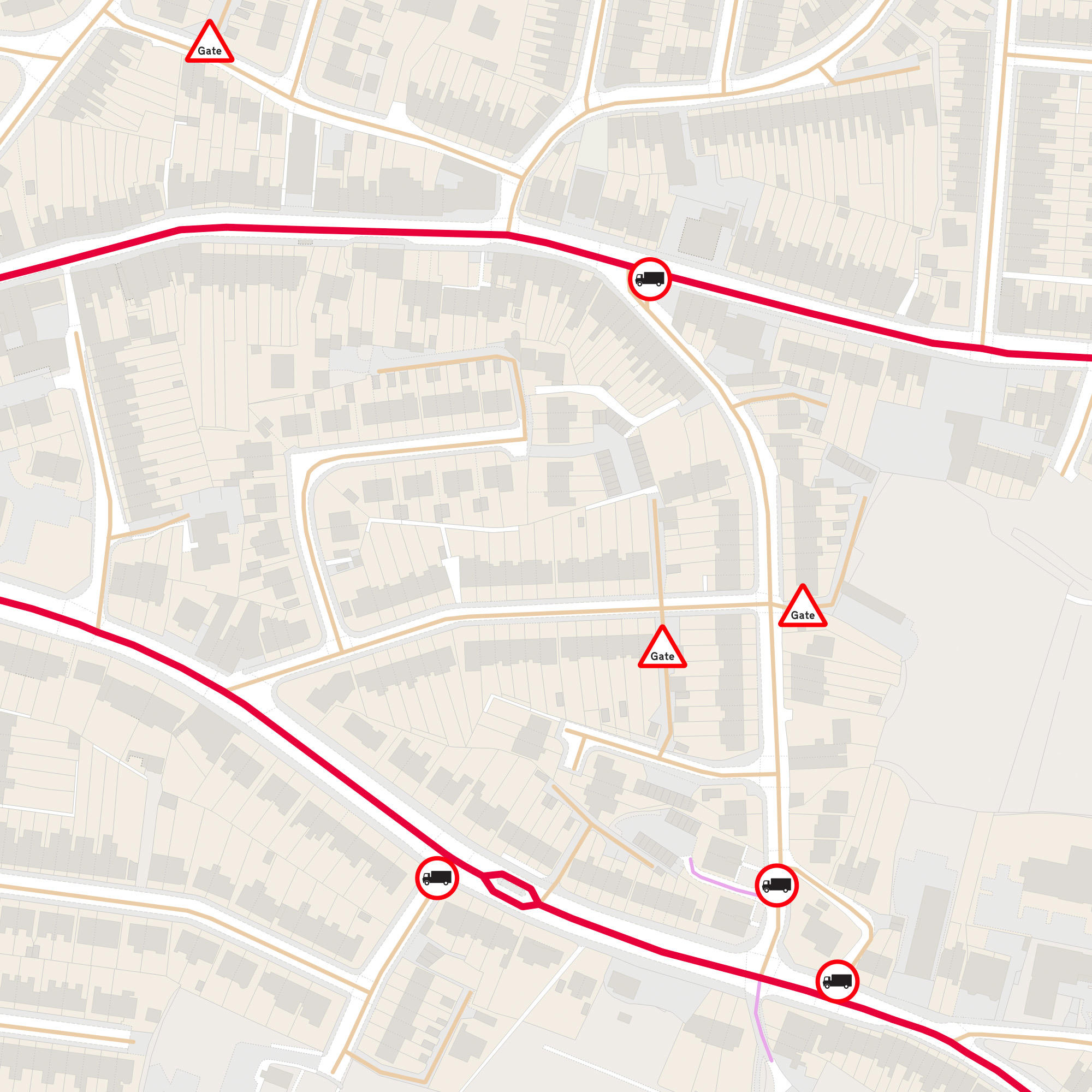
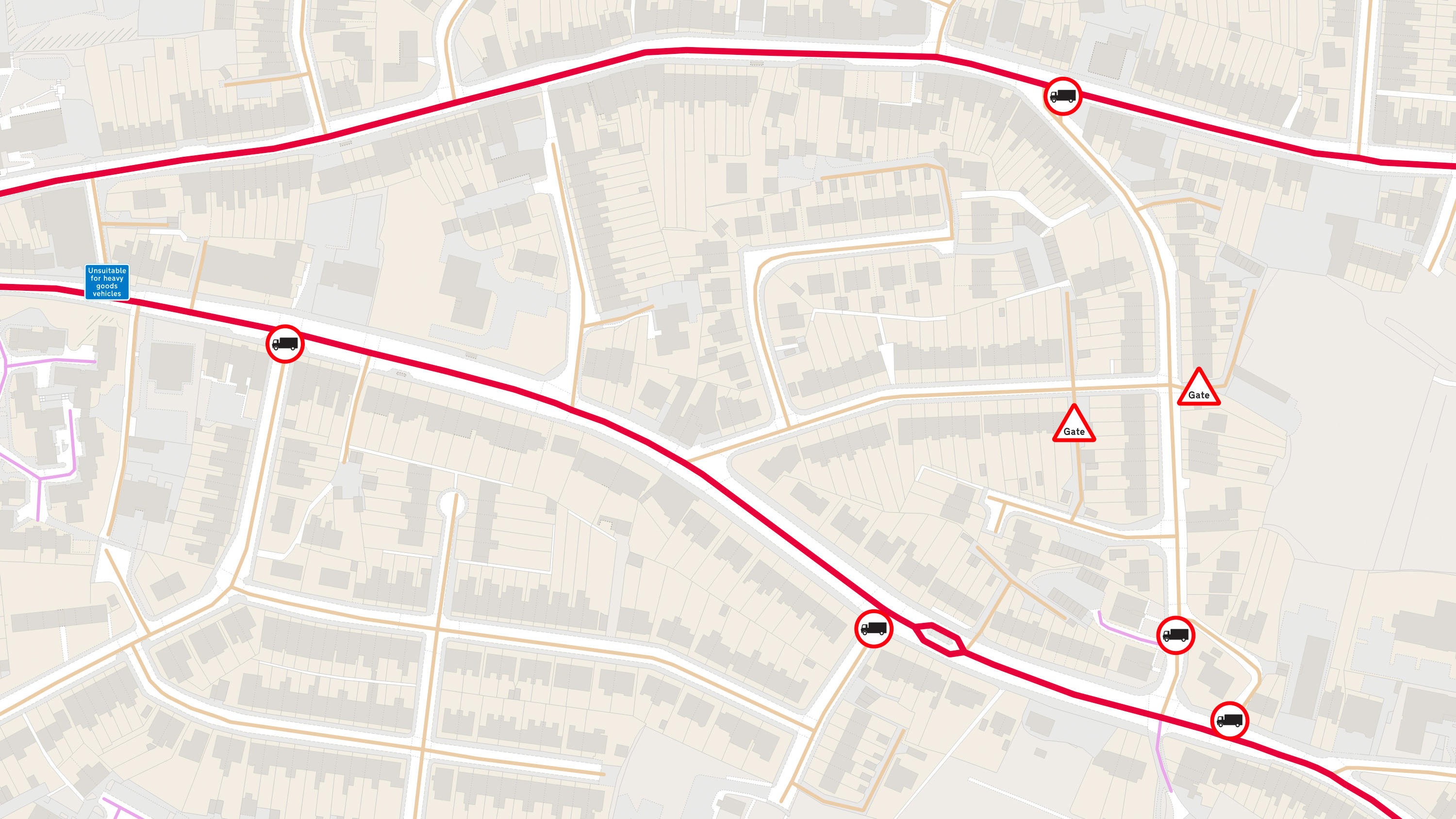
OS MasterMap Highways Network - Routing and Asset Management
For vehicle routing and navigation software providers, this data gives you all you need to get your users safely to their destinations: turn, height, weight and width restrictions – and even bollards and traffic calming.
This product is updated monthly