Secret wartime bunker surveyed for the first time
The complex was used to relay Enigma messages to Bletchley Park during the Second World War
OS was asked by HMLR to survey a complex of underground tunnels and rooms when it was taken over by a new owner.
The site, in Folkestone, dates from the Second World War and was used for relaying intercepted naval communications, such as Enigma messages, from coastal shipping in the English Channel onwards to Bletchley Park. It was originally designed as a wartime telephone exchange as part of the defence network and is rumoured to have played a part in the command of Operation Pluto to supply critical fuel supplies to allies in Europe.
The complex has been closed for decades until it was bought by its current owner. There is no record of a previous survey nor has it been seen by the general public, although a couple of amateur historians and YouTubers have breached the site over the years.
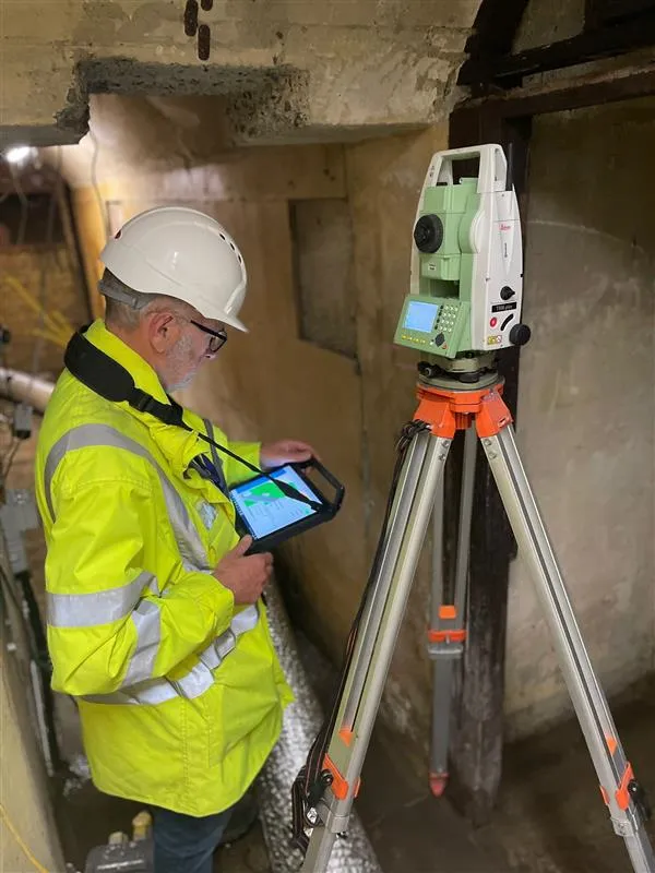
Mark Robson was the lead surveyor at the tunnels. He said:
"It’s been a long time since I’ve worked underground in my near 40 years at Ordnance Survey; in 1994 I assisted with a levelling survey through the Channel Tunnel service tunnel. It’s fascinating to note that more than 200 years before that, OS was mapping Kent for military purposes, preparing for a possible French invasion. It’s been an absolute privilege to survey a part of our more recent military history that played a significant role in the defence of our nation."
The complex is made up of a first, ground and lower floor, although currently only two are accessible. At the entrance is a concrete blockhouse with a set of steps going down into the tunnel complex with a series of rooms set at an angle to the connecting passageway; another passageway provided an escape route back to the road.
The lay-out of the bunker and restricted visibility proved a challenge for Mark and his colleague Joel Prince to work. He was able to use Global Navigation Satellite Systems survey equipment to coordinate a starting point for the survey. Then a theodolite with laser measurement was used to capture the underground detail ensuring the survey met the OS accuracy required for urban areas.
The information has now been passed to HMLR as a requirement of the site’s handover to the new owner Dan Smith.
Dan is fascinated with wartime history and has an aspiration to share that passion. Subject to planning permission, he is planning a privately funded project to turn the complex into a heritage centre and open the tunnels to the public, with the bunker just one part of a wider project in the area.
"My hope is to have the bunker refurbished to as near to original as possible, including as a Second World War era exchange that would have originally been there. I would love to open it as a museum – what better place to remember the area’s rich military heritage. It was great to be able to share such a significant site with the OS surveying team and having the complex mapped is a great step forward in the project."

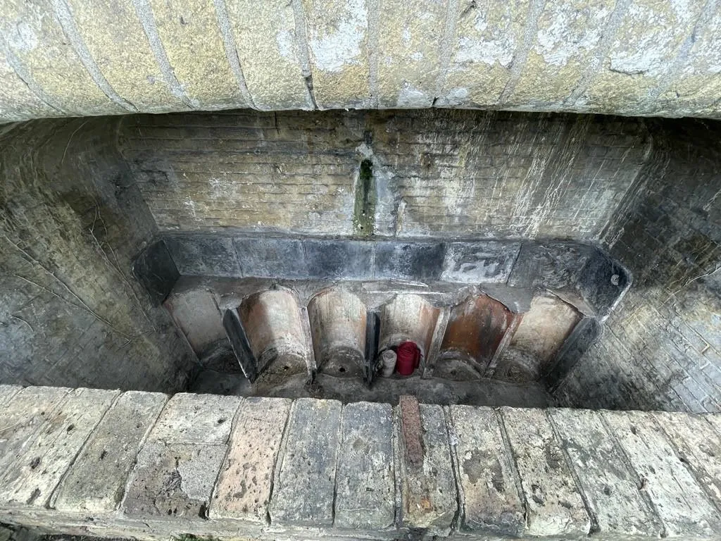
Folkestone is an area brimming with history. The bunker sits at the bottom of the Road of Remembrance, renamed in the 1920s because tens of thousands of troops marched down the hill in the First World War as they embarked for France from Folkestone Harbour. The harbour was later known as the gateway to the trenches. Folkestone also played a big part in the Dunkirk evacuation in the Second World War. And while a recent landslip on the hill above the bunker dislodged some vegetation and meant the temporary closure of the road in front, the clear-up work also revealed the existence of a Victorian urinal, long since deleted from any mapping but has now been resurveyed.
OS has been delivering surveying services for HMLR since 2013 and the success of this relationship was marked by the renewal of the contract in 2023. OS completes up to 2,000 surveys a month for HMLR using a combination of GPS kit for on the ground surveys or drone capture. OS surveyors regularly attend sites such as new housing developments as well as individual properties for their first registration.
You can contact Dan Smith about his project at roadofrememberancebunker@gmail.com.
For further information about surveying at OS, please visit What Ordnance Survey Field Surveyors do | OS and Meet OS Placemaker - Hannah | Blog | OS

Our highly accurate geospatial data and printed maps help individuals, governments and companies to understand the world, both in Britain and overseas.