Model wind direction and lines of sight
Make better decisions about where to locate wind turbines and mobile phone masts. OS Terrain 50 lets you model wind direction and lines of sight at your desk, meaning fewer site visits.
Make better decisions about where to locate wind turbines and mobile phone masts. OS Terrain 50 lets you model wind direction and lines of sight at your desk, meaning fewer site visits.
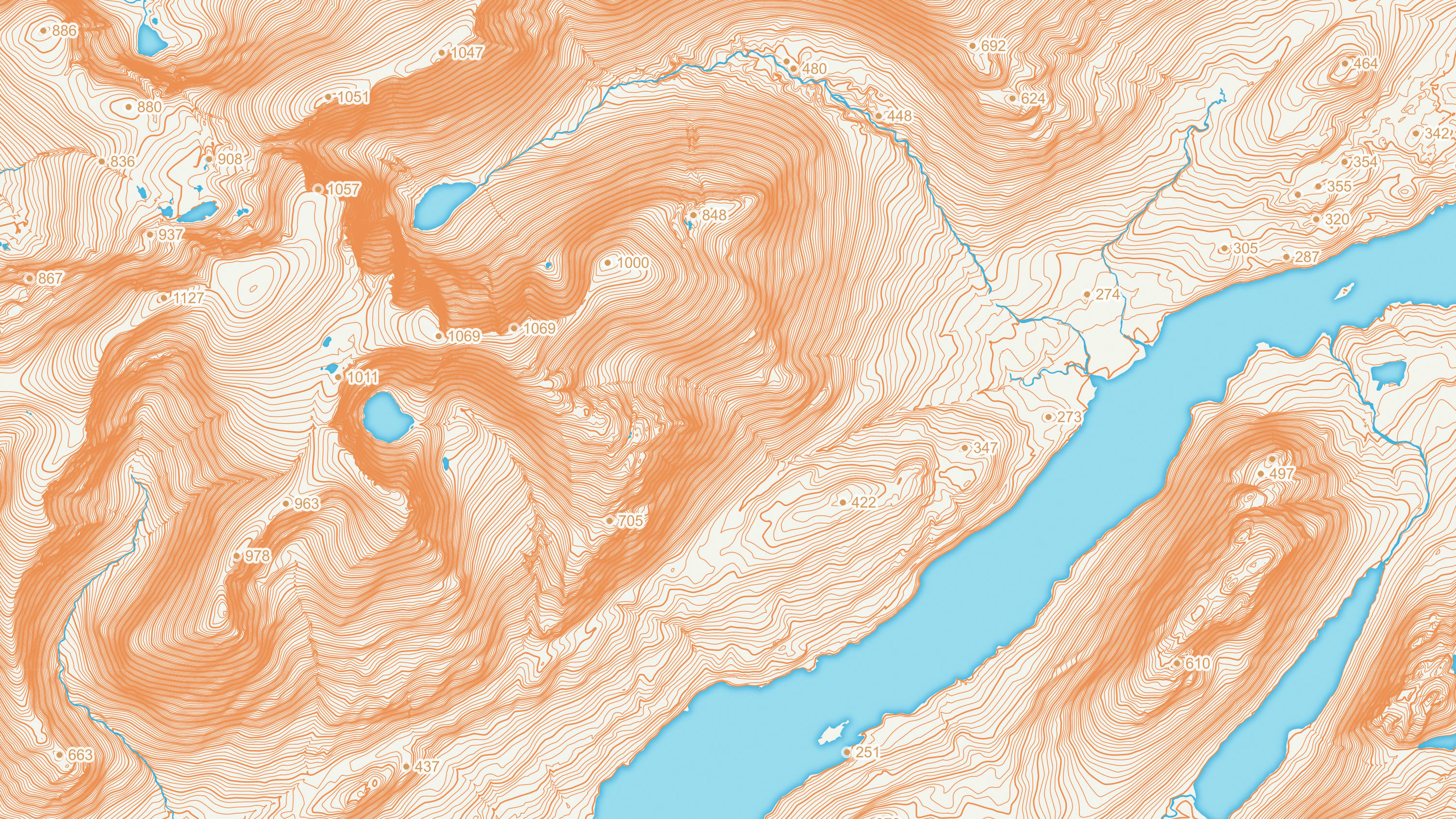
Get the bigger picture about flood risk, soil erosion and pollution. By showing steep hillside gradients, OS Terrain 50 helps you plan flood defences and safeguard the landscape.
With the contours version of OS Terrain 50, you can shade in hills to show their height. This extra sense of depth is ideal for walking maps and apps.
The contours dataset also includes mean high and low water boundaries.
OS Terrain 5 is a detailed digital terrain model (DTM) of Great Britain.
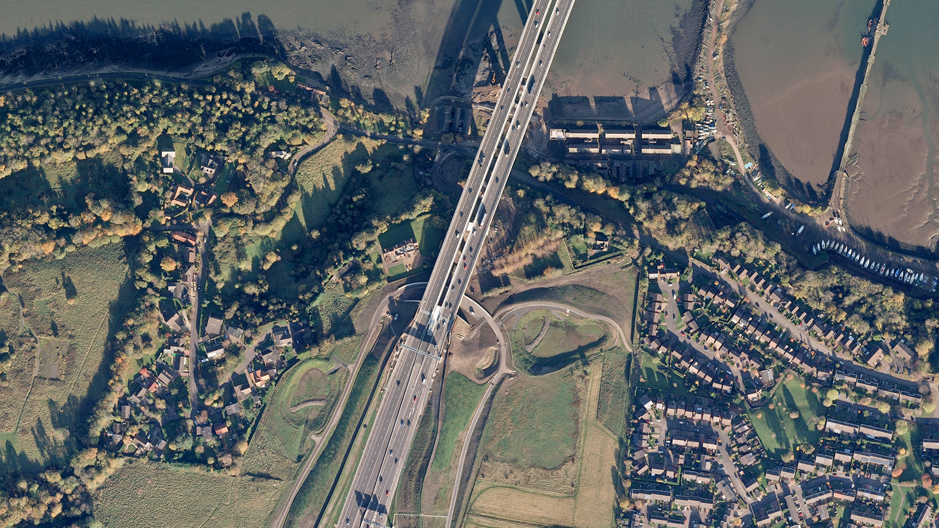
Digital colour-balanced and corrected for geometric distortions (orthorectified) aerial photography for Great Britain.
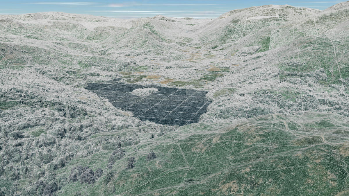
OS 3D Mesh is a product providing a photorealistic 3D representation of the surface of the Earth and features above it, such as buildings, roads, and vegetation.