PNT: the how, where, and when
What is Positioning, Navigation and Timing (PNT)?
There are three elements of PNT:
- Positioning – the ability to precisely determine one’s location and orientation, predominantly two-dimensionally although three-dimensional orientation can be determined when required.
- Navigation – the ability to determine both the current and desired position (either relative or absolute), and apply corrections to course, orientation, and speed to attain the desired position – from anywhere in the world, from sub-surface to surface, and from surface to space.
- Timing – the ability to acquire and maintain accurate and precise time from a standard (such as UTC), anywhere in the world and within user-defined timeliness parameters.
Much of the UK’s infrastructure – telecoms, financial services, power generation, agriculture – relies upon access to GNSS services, which provide accurate, accessible and consistent PNT information. Even small discrepancies of these services can impact crucial economic and infrastructure activities like deals made on the stock exchange, international communications, or international trade.
As a space-based system, there are a number of threats and vulnerabilities associated with GNSS. These range from human error or intentional disruption to natural issues like solar events. The critical importance of PNT will only continue to grow as technology advances, with increasing connectivity between machines, both in the professional and domestic contexts, which rely upon PNT technologies to operate. This means the UK’s PNT resilience must be very high to ensure that our digital lives, economy and infrastructure can operate when under threat.
Ordnance Survey – 1791-2023
OS has a rich history in modelling the changing shape of Great Britain. From Charles Lennox’s first trigonometrical survey of 1791, to the creation of hundreds of millions of maps to support Britain’s war efforts in both World Wars, to the 1:1 accurate mapping of Britain’s cities that we use today, we have played a crucial role in measuring and mapping the country’s topography, landscape, and cities – data which is now a vital component of the national PNT systems relied upon today.
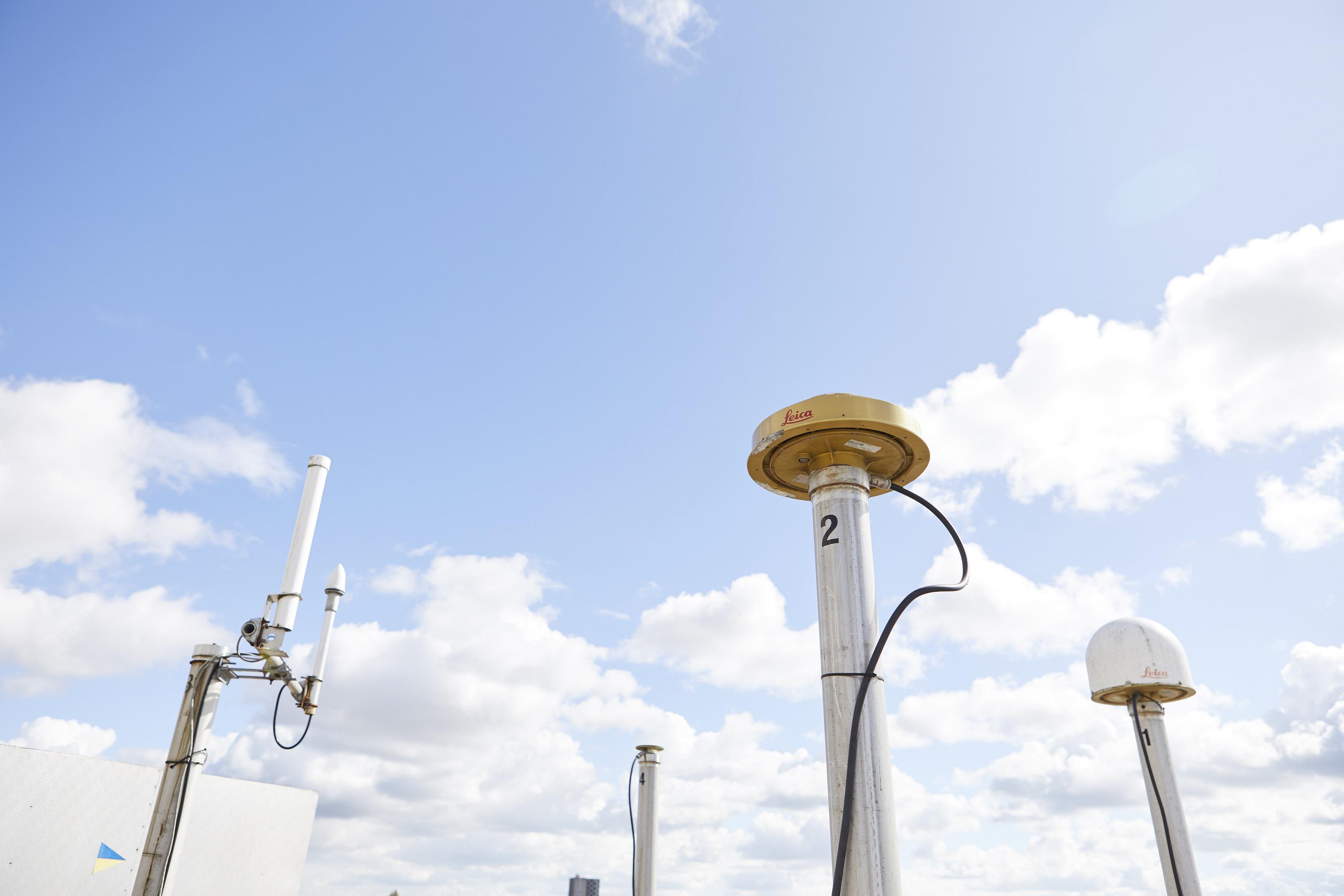
As a result of this vast experience, OS’ data collection and geospatial intelligence systems are globally leading. Moreover, we have, for decades, built OS Net – our positioning system used to produce coordinates and accurately detail natural and man-made features within Great Britain – and used it within our operations.
OS Net was established in 2003 and includes an extensive network of 115 GNSS base stations across the country which provide positioning data that we update tens of thousands of times a day. This provides geospatial data for use in the GB coordinate reference frame, as well as to help correct errors in any satellite system. The 115 stations were chosen deliberately to ensure they have the longest possible lifespan and face the least risk of disruption, which ensures the system is as resilient as it can be, ensuring this critical infrastructure is protected from as much risk as possible.
OS - expertise
When OS’ rich history and extensive current operations are considered together, our PNT expertise and distinct position becomes clear. We are experts in mapping, based on centuries of important work shaping the map of Britain we know today; we are skilled at developing insights from complex data; and we are well versed in building and utilising PNT technologies within machine-to-machine GNSS based networks. We have a unique portfolio of skills that, when seen through the prism of PNT, are important in ensuring the resilience of complex and critical infrastructure that sit at the foundation of the UK.
Emerging markets
Our expertise in building a resilient, effective PNT function in Great Britain has laid the foundations for a range of new, technology-first industries, such as:
- Autonomous vehicles – PNT is crucial for their navigation, particularly in low visibility conditions. By ensuring the provision of pinpoint, resilient PNT data, OS is helping autonomous vehicle development overcome a major barrier and the industry to further innovate.
- Agriculture – PNT gives farmers greater ability to plan and manage how they grow crops, improving resilience against extreme weather events and climate challenges while also providing important national security, which is at risk due to the growing threat of food scarcity caused by climate change.
- Smart cities – defined by their greater autonomy, smart city infrastructure involves less direct human involvement and more machine-to-machine communication to organise the myriad functions of an urban environment. Much of this is reliant on PNT to enable not only communication between these autonomous systems but to ensure they accurately log and report location when needed – foundational aspects of their operations.
This is just a select list of examples of PNT’s growing utility and importance in industries crucial to national security. As these, and many more, continue to undergo digital transformation, PNT services will only grow in importance and criticality, with OS well positioned to apply its technology and expertise to support these changes.
Helping other countries to optimise PNT
OS has not only supported the advancement of British industry and the country’s navigation through an ever-changing technology landscape and global economy, but is also currently playing a key role in facilitating international development.
Geospatial intelligence, including GNSS systems, is important for nations developing their mapping and relevant technological infrastructure. Such systems can play key roles in developing new industries, helping build resilience to climate change and natural disasters, and address issues like food security and deforestation. OS is helping a number of nations around the world to further develop via a resilient, effective PNT infrastructure.
An example of this is our work in Guyana. Its Continuously Operating Reference Stations (CORS) network, which is relied upon for PNT information, was in disrepair and had fallen out of use. As a result, inefficient, time consuming and expensive surveying methods were used instead. The Guyana Lands and Survey Commission (GLSC) worked with OS to update its geodetic infrastructure, helping build key capabilities which ensured the effective use, maintenance and expansion of the network. The GLSC is now playing an important role in helping the country work towards achieving its Sustainable Development Goals, such as creating more efficient transport systems, secured land tenure, better government, improved economy, and happier citizens.
Learn more
PNT systems, services and processes are key enablers for our technology dominated lives, without PNT we will not have access to digital technologies and the benefits they offer.
Due to its reliance on GNSS technologies, Ordnance Survey is committed to development of understanding and solutions for resilient PNT. Our experts are ready to help you understand the use of GNSS to counter threats and vulnerabilities.
Discover OS Net data, providing GNSS.

Our highly accurate geospatial data and printed maps help individuals, governments and companies to understand the world, both in Britain and overseas.
Further support
For further help about how our data can transform your organisation, contact us today