New data: Transport planners to benefit from routing one stop shop
Press Office
The OS Multi-modal Routing Network (OS MRN) product has been specifically developed as part of OS's responsibilities under the Public Sector Geospatial Agreement (PSGA) and in response to customer feedback. Where customers previously processed and joined multiple layers of transport data, all routing information will now be in one place, reducing the effort required in preparing the data for use.
OS MRN is designed in OpenStreetMap schema which is widely supported by routing software. Where the road, rail, path and ferry networks are included, so also are over 300,000 key transport sites that connect them, allowing the planning of routes from start to finish, for example from road to rail via a train station. Information on road restrictions, vehicle access restrictions (e.g. maximum height and weight), road speeds and pavements are also included. This enables understanding of the turn by turn routes you can take and if there are any restrictions to your mode of transport or vehicle. Providing all transport information into a single product will support routing applications and analysis.

The new product will support local authorities as they develop their Transport Plans and Active Travel policies, ensuring they are aligned to government policy. They will be able to plan safe routes to schools and colleges and carry out improved routing analysis. Emergency services will also be able to plan expected response times for incidents and commercial organisations will also be able to optimise freight logistics.
The OS MRN is a premium product and is available for free to the Public Sector under the PSGA through the OS Data Hub. It is available to OS Partners under the Premium Plan through the OS Data Hub. The OS MRN will be a download-only dataset and a full resupply will be provided monthly.
"The release of the OS Multi-modal Routing Network is a great achievement, bringing together in one place OS’s transport network for Great Britain and the hundreds of thousands of sites where those different networks connect. Having listened to the needs of our customers, they will no longer need to join up multiple layers of data but can find them in one place. This is going to make a big difference to them, whether using simple routing or working on something more specialist."
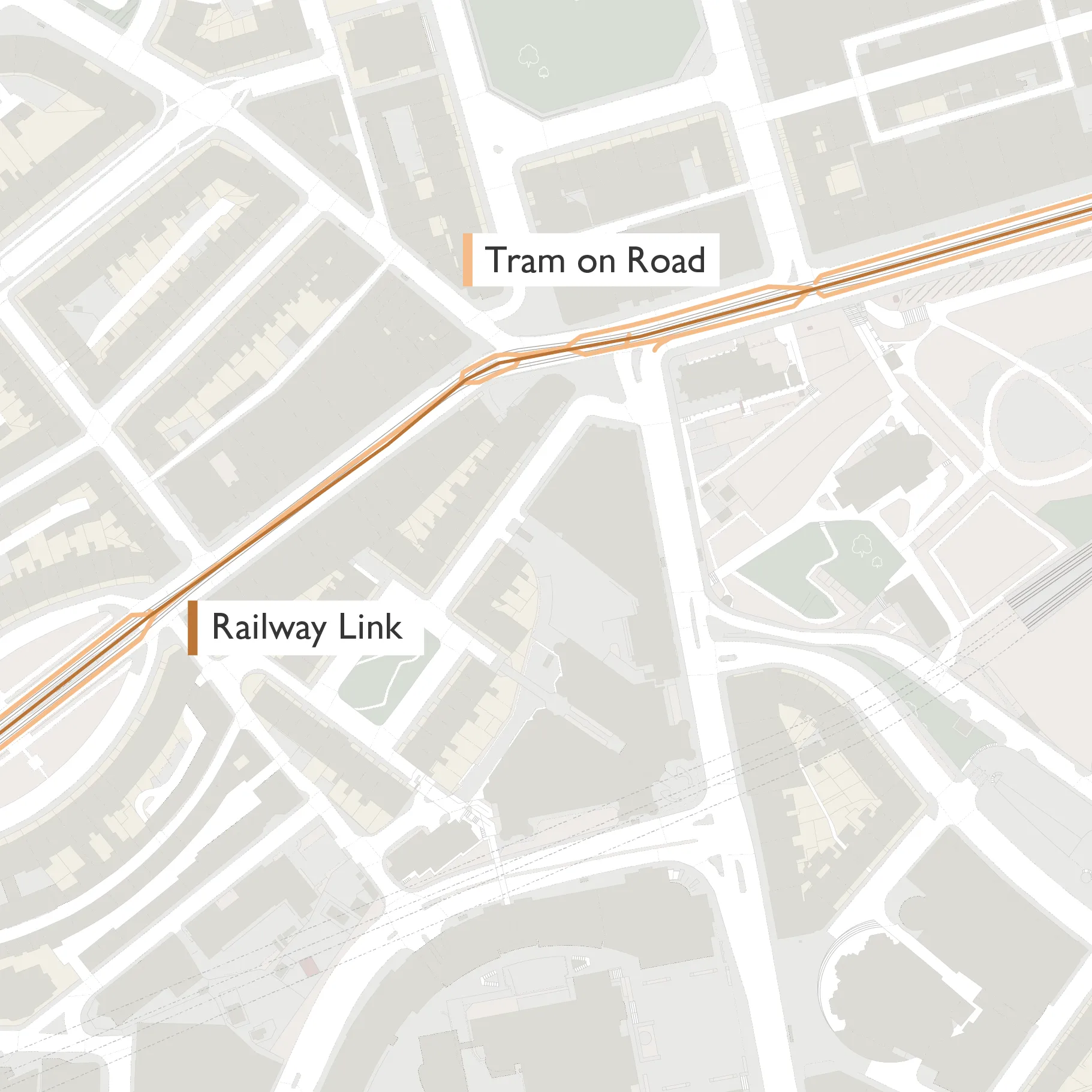
Tram Track Attribution
In addition to the release of the OS MRN, a brand new enhancement to the OS National Geographic Database Transport theme is the new Tram Track attribution – showing where trams are present on the road network.
This new information will support infrastructure and transport network management. Tram companies and Local Authorities can use it to support planning of maintenance and street works, which could create temporary disruption to tram services. It will also support understanding where there is a risk for cyclists and other road users arising from tram tracks using the same road space.
This new enhancement, which was created using data science techniques, includes a new feature type called Tram on Road, as well as new attribution against the Road Link. The tram network is already available in the Railway Link feature type and was released in September last year.
OS provides its data and services to the emergency services and wider public sector organisations through the PSGA. The PSGA is a contract between the government and OS for the provision of geospatial data across multiple themes, including buildings, transport, structures, addressing and land. The contract delivers key data to public sector members for use in everyday settings to support provision of critical services to the public.
Users can access the OS MRN and the new OS NGD data via the OS Data Hub.
Sharing the latest news about OS. We can license you to use OS maps in print, online and film format. For more information and resources for journalists, bloggers and media professionals, email pressoffice@os.uk or call 023 8005 5565.
Explore the OS Data Hub
With over 20,000 updates to our databases every day, you have access to a comprehensive and up-to-date set of authoritative data through the OS Data Hub