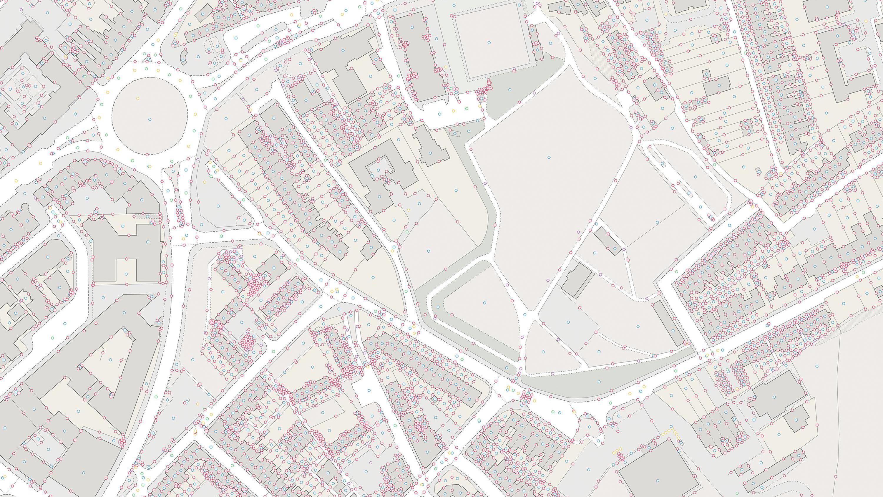
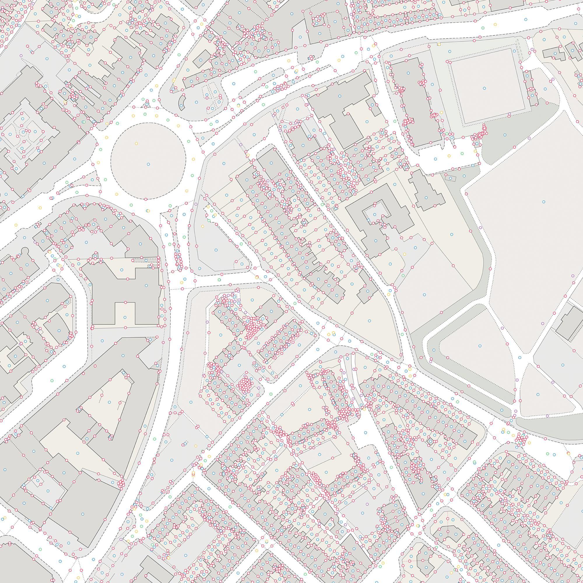
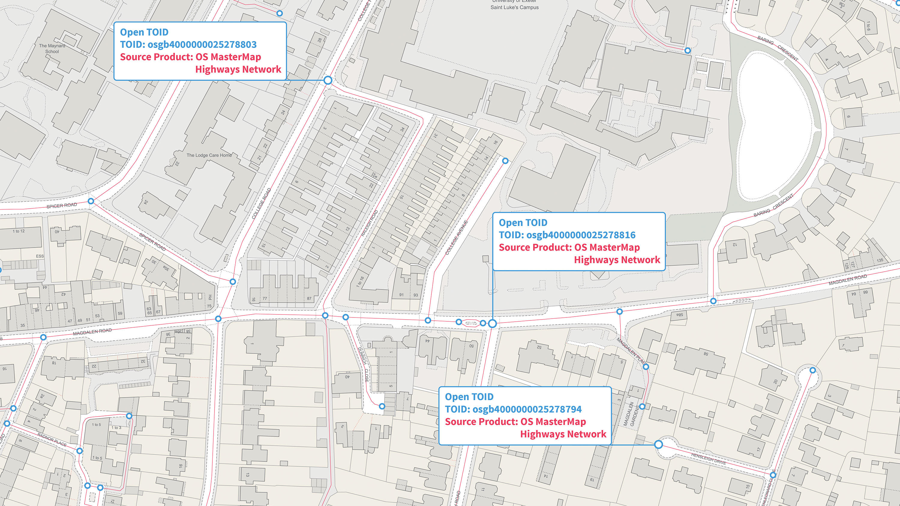
OS Open TOID

A TOID (Topographic Identifier) is a unique and persistent identifier for each and every feature found in OS MasterMap products. This dataset shows unique identifiers for a wide range of landscape and built environment features, with a generalised location, extracted from OS MasterMap products.

  • Identifiers
  • Download
  • Energy & Infrastructure Plan
  • OS OpenData Plan (FREE)
  • Premium Plan
  • Public Sector Plan

This product is updated every six weeks

Representation of data provided

What OS Open TOID provides you with

Authoritative identifiers for real world objects

TOIDs are the authoritative identifier assigned to and uniquely identifying real world objects, being essential for customers to link their own data to and track change over time.

Easy to share

OS Open TOID will enable data to be shared for a wide range of landscape and built environment features by providing them with a unique identity and generalised location that can be used by everyone. Watch our OS Open TOID introduction video.

Complete topographic data

All Topographic points, lines and polygons present in OS MasterMap Topography Layer and junctions, roads and path present in OS MasterMap Highways Networks are also part of this product – so you can be sure you’re not missing out.

Authoritative source

The TOIDs in OS Open TOID are allocated by Ordnance Survey. This means you can have confidence you’re accessing an authoritative source of these identifiers.

Identifiers you can trust

The TOID is never re-used, once its allocated to a feature, that’s it, it will never change or be reused.

OS Open TOID

Technical information

Specifications

Access
  • Download
Data theme
  • Multiple
Data structure
Vector - Identifiers
Coverage
Great Britain
Scale
1:1250 to 1:10,000
Format
  • CSV
  • GeoPackage
Ordering area
  • Customisable area (100km2 tiles)
OS Data Hub plan
  • Energy & Infrastructure Plan
  • OS OpenData Plan (FREE)
  • Premium Plan
  • Public Sector Plan

Documents and Support

Getting started guides

  • OS Open TOID - Overview
    The overview introduces the product and gives context for all users. It highlights key features, provides examples of potential uses for the product and lists details like file sizes, supply formats, etc.
    pdf
    v1.1
    1.3 mb
    September 21, 2020

Technical specification

  • OS Open TOID - Technical specification
    The technical specification provides detailed technical information about the product. It is targeted at technical users and software developers.
    pdf
    v1.1
    473 kb
    September 21, 2020

Release notes

Additional information

TOID features

The register for TOIDs is not exhaustive. Not all TOID features are included as some feature types are not useful for third party data references, however all TOIDs are provided for each feature type we have included.

TOID geometry

TOID geometry always lies within the polygon. We are using a pole of inaccessibility algorithm to selection a generalised point location for polygon which can be used to position a label for that feature. The aim is to provide a point which is most suitable for labelling the polygon. In the situation where we have a multi-polygon feature (only found in our Sites Layer), the point is placed in the largest polygon.

OS Open TOID

Get this product

What you get

Key features
  • Authoritative identifiers for real world objects
  • Easy to share
  • Complete topographic data
  • Authoritative source
  • Identifiers you can trust
Category
Identifiers
Access
  • Download
Data structure
Vector - Identifiers
Update frequency
Every six weeks

How to access

OS OpenData is free

Ready to get started with OS data?

Take the next step by signing up to the OS Data Hub and create your first project today.

Sign up to the OS Data Hub

Get this product

Access for free and benefit from using OS data

Get help

Further support

For further help about how our data can transform your organisation, contact us today

Contact us