Overview
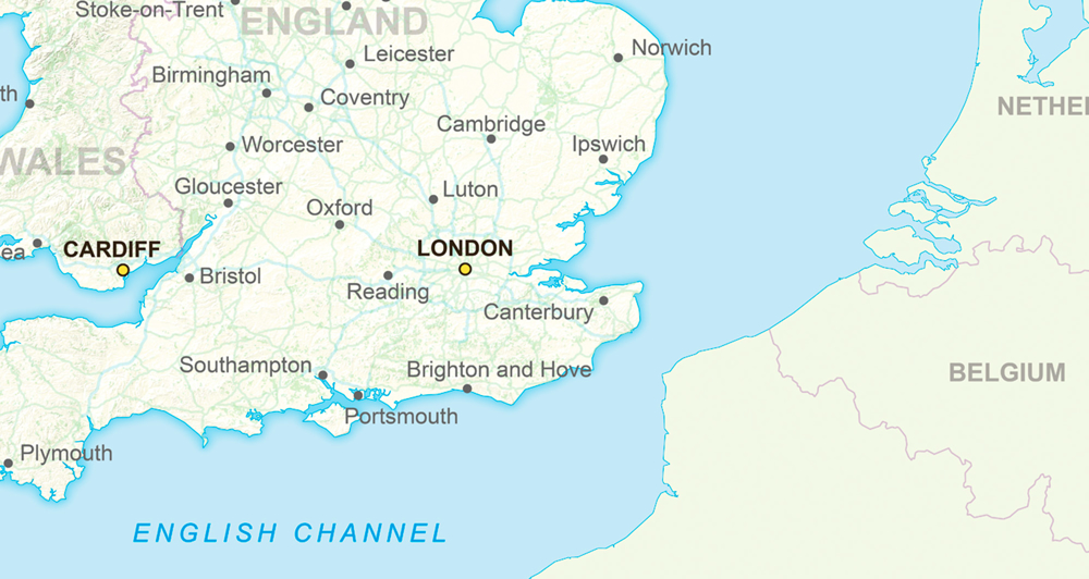
Zoom in from here. This is ideal as an initial map for your GIS. It highlights Britain while showing neighbouring countries of Europe.
Your message will stand out as there is no clutter on this map. It's also great for hand-outs, desktop publishing and classroom use.
The GB Overview Map is free to view, download and use for commercial, educational and personal purposes.
Choose your map
Download the map that is right for you. Ordnance Survey provides a map highlighting roads and cities, and another with terrain to the fore.
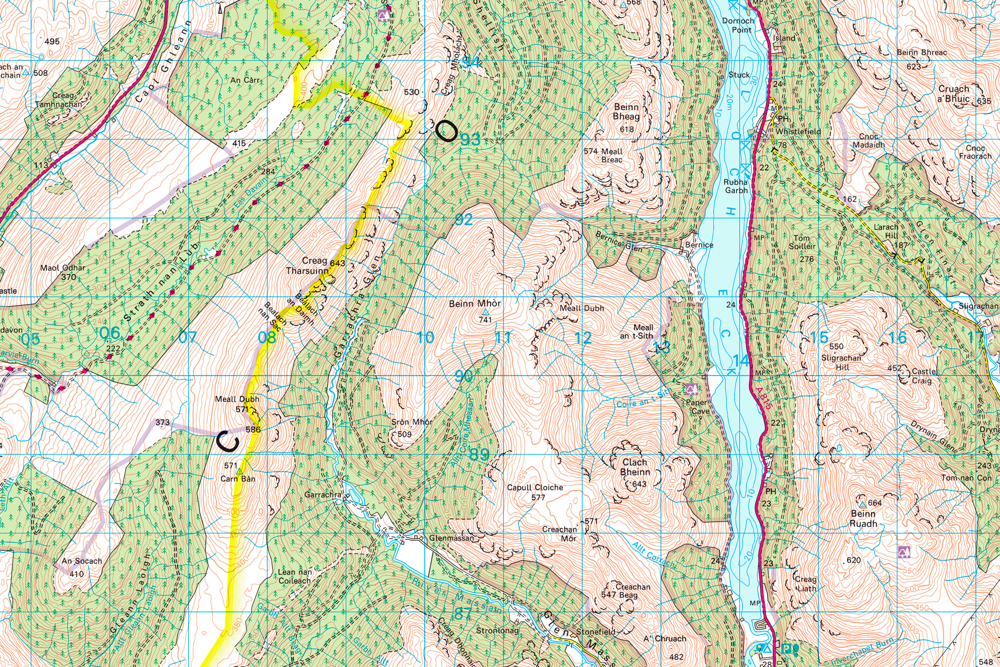
Need a more detailed map?
If you need to see pubs, pylons and other places of interest we recommend 1:50 000 Scale Colour Raster.
But if you need an even simpler map for presentations and classroom activities, we also publish free outline maps of Great Britain.
How to get this product
Our open data products are covered by the Open Government Licence (OGL), which allows you to:
- copy, distribute and transmit the data;
- adapt the data; and
- exploit the data commercially, whether by sub-licensing it, combining it with other data, or including it in your own product or application.
We simply ask that you acknowledge the copyright and the source of the data by including the following attribution statement:
- Contains OS data © Crown copyright and database right 2022
- Where you use Code-Point Open data, you must also use the following attribution statements:
- Contains Royal Mail data © Royal Mail copyright and Database right 2022
- Contains National Statistics data © Crown copyright and database right 2022
Case studies
BT connected to UK mapping data
British Telecom (BT) combined data from Ordnance Survey and Ordnance Survey of Northern Ireland in one seamless service to create a dataset for the UK.
Technical specification
| Key Features | What this product offers |
|---|---|
| Format | GeoTIFF LZW compressed 254 dpi |
| Data structure | Raster |
| Colour options | 256 colours |
| Scale | 1:5,000,000 |
| Update frequency | Annually (December) |
| Supply | Online downloaded |
| Coverage | Great Britain and neighbouring parts of Europe |