Unlocking efficiencies in property and insurance sectors through Unique Property Reference Numbers
Identifying specific locations with precise accuracy
Increasing efficiency in business operations is a goal all organisations strive for. After all, who wouldn’t want to maximise their resources, improve productivity, reduce costs, and enhance their customer service?
That’s all well and good, but in a competitive marketplace, it’s often easier said than done.
But Nationwide Building Society, one of the largest mortgages lenders in the UK, and Hiscox, a specialist commercial and personal insurer, have both utilised a hidden tool that is driving better data management and quicker decision making across their respective sectors.
In an environment grounded on risk-based decisions, Unique Property Reference Numbers (UPRNs) have delivered these crucial efficiencies.
What is a UPRN?
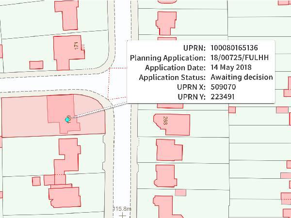
UPRNs are a numeric identifier for every addressable location across the UK. This could include any kind of building, or an object that might not have a ‘normal' address, such as a bus shelter or a utility service. The UPRN ensures everyone refers to the correct location which reduces the ambiguity of identifying a single flat in a block of flats or even finding an object that has no literal address. UPRNs exist throughout the property’s entire lifecycle - from planning through to demolition.
Not only do UPRNs serve as a unique identifier for a single addressable location, but, like a car registration number, they allow organisations to link other information and records, exchange them, and keep their data consistent within their internal tools and processes. Given the UPRN remains with a property throughout its lifecycle, it can be used to provide a single source of truth about a location, despite any changes in function it might undergo.
How to use the UPRN
So, it’s no surprise that this reduced ambiguity, and the ability to refer to consistent data about a precise location, is extremely appealing to businesses that make risk-based decisions.
Currently, commercial property data is captured and held, if at all, in numerous physical and digital forms, by multiple stakeholders. It can be archaic, fragmented, and often counterproductive.
“As a mortgage lender, it’s really important that we understand the property that somebody wants to lend on,” explains Robert Stevens, Head of Property Risk at Nationwide Building Society. “Over the last few years, Nationwide have been working with Ordnance Survey (OS) to build a digital journey, which allows them to make risk-based decisions upfront – and the UPRN is key to that.”
The UPRN allows Nationwide, at a letterbox level, to understand where a property is and link other key data attributes to it, enabling them to decide how sustainable that property is and if it is a property they are prepared to lend on.
Robert Stevens continues: “The UPRN allows us to make a very quick decision. If a property may be at risk of flooding we want to know really quickly. What we don’t want to do is allow a customer to get emotionally attached to a property only to find out, further down the line, that it isn’t mortgageable or insurable.
“By having the UPRN and linking that data we can say yes or no to the customer very quickly, which is why it’s so key to our decision making.”
Likewise at Hiscox in the insurance sector, which insure hundreds of millions of pounds worth of assets, the precise accuracy of UPRNs has helped them deal with what they call ‘spiky exposures.’ Dan Bishop, Head of Insurance Analytics at Hiscox, explains: “As an insurance company, insuring these assets, we like to know where they are.
“What we have is what I call very ‘spiky exposures,’ so we would like to understand if there are lots of our customers all living very close by, because if there was a big event like a flood, a windstorm, or a big fire event, that would obviously have a significant impact on our losses and increase the capital of the money we have to hold and set aside to manage that risk.”
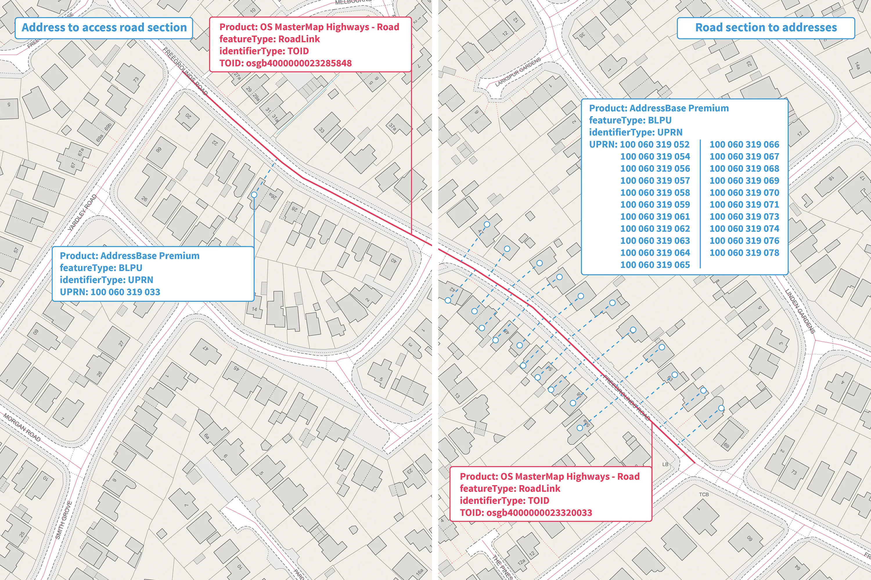
The kernel of what makes OS data so valuable to Hiscox is the ability to locate a property in the landscape as accurately as possible. To do this, Hiscox use UPRNs, AddressBase Premium, and OS MasterMap. This is their fundamental starting point.
In basic terms someone who lives next to a river is probably riskier than someone who lives at the top of a hill. But using data from OS MasterMap like building and terrain heights, building footprints, and the boundaries around a property, can help Hiscox understand even more granular exposures, as well as improve customer experience and retention through increased understanding of their property.
Dan Bishop said: “Hiscox love paying claims to our customers, and we love paying claims with a smile on our face. But what we don’t love is paying claims when we didn’t know we were likely to have to pay them.
“So unexplained exposures and locations, in a place we didn’t think they were located, is the type of ambiguity we don’t like. But now we use UPRNs and other OS data we know exactly where insured items are located. We can hold that in our database and it's absolutely a key tool for accessing other information.”
Speeding up the process
Every property purchase is unique. But according to the Post Office, the average time it takes to buy a house, if you’re not part of a chain, is 15 weeks. The UPRN can reduce this timeframe, as Robert Steven explains:
“As people start to understand the UPRN and what it means, and embed it into their decision making, it will help speed up the house buying and selling process within the UK.
“But this is just the start. We have a really collaborative relationship with OS, and we are looking at new data opportunities with them. The UPRN is the key, and it opens the door, but there are other datasets that we’re working on with OS which we feel will improve our decision-making capability even further and really optimise customer journeys.”
James MacTavish, OS Channel Manager, added: “We are already seeing the UPRN delivering significant benefits to both Nationwide and Hiscox. In recent years, the recognition of the UPRN’s value has increased as more organisations, both government and commercial, have adopted it because it applies a common standard for addressable buildings and objects, and becomes the geospatial glue to collate, share, and connect data from various sources. This helps reduce ambiguity and ensures everyone refers to the correct location.
“UPRNs are supercharged postcodes essentially, that have the potential to deliver efficiencies across many operational areas, including data sharing and management, time efficiencies, customer service, and improved decision making.”
Get in touch
To discuss how accurate location data can benefit your organisation, and to learn more about OS premium data services, please feel free to contact me on Nathan.Ward@os.uk

Channel Sales Development Manager
The power of addressing
Get further information on the power of addressing data and the UPRN
Products and solutions featured in this insight
OS MasterMap Building Height Attribute
OS MasterMap Topography Layer is a dataset showing building heights for Great Britain.
OS MasterMap Topography Layer
OS MasterMap Topography layer provides a map dataset of Great Britain's landscape – from roads to fields, to buildings and trees, fences, paths and more.
AddressBase Premium
AddressBase Premium offers full lifecycle information of a property that can be used within geographical information systems & database systems.